June 15 – 16, 2019
~ submitted by Julianna Wells
The group of 8 met at the Elk River Trail parking area on a beautiful June morning and headed out at 8:45am. The trail was dry and the forest was showing it’s many shades of green all along the way.

Living the best adventure life, since 1958

June 15 – 16, 2019
~ submitted by Julianna Wells
The group of 8 met at the Elk River Trail parking area on a beautiful June morning and headed out at 8:45am. The trail was dry and the forest was showing it’s many shades of green all along the way.

June 17th, 2019
~ submitted by Ken Warren
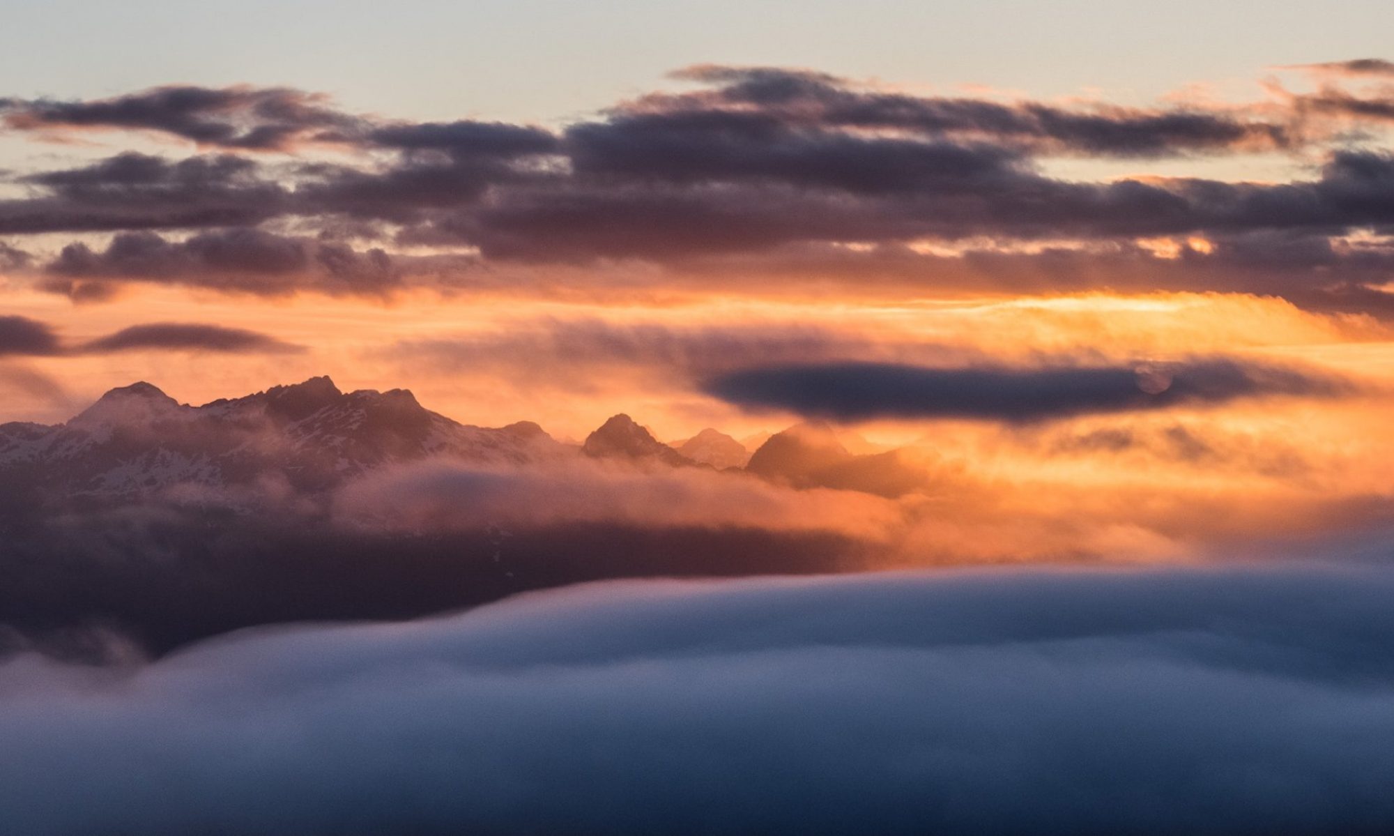
It was a clear and warm morning when 10 Ramblers and a guest tackled Crest Mountain, most for the first time. We ground our way up the switchbacks in good time with no snow until we hit the plateau.


June 9th, 2019
~ submitted by Matthew Lettington
We started up the climber’s trail under overcast skies. The forest was warm and muggy, but the ground was dry, allowing us to move over the complex terrain quickly. At every step, we watched our footing, ensuring the roots, rock, moss and other debris didn’t cause us to lose our footing.
As we climbed above 500 m, we met two men and a dog. They had overnighted at a muddy tarn and were on their way back down. After some conversation, they wished us well, and we continued our climb.


~ submitted by Quinn Park
May 4th, 2019
East Sooke Park is an amazing place that folks go to learn. They learn to hike, they learn to rock climb, slackline, they learn to navigate, and they learn about west coast beach ecosystems.
On this trip, on this corner of Vancouver Island, I tasked myself with learning to lead a trip. And it began before the trip with the logistics of organizing IMR members and non-members alike interested in the trip. On the morning of the hike, nervousness struck – what would I forget? First-aid kit? Sunscreen? Water? Did I forget to email anyone?
How funny the nervousness is. Is it pointless as nothing pertinent was left behind? Or is it a beast that helped me not to forget anything?

~ submitted by Mary Hof
May 26th, 2019
I was lucky to lead for a group of 7 to one of my favourite places, Bald Mountain in Lake Cowichan on May 26.

~ submitted by Matthew Lettington
May 25th, 2019
Our first work party for the Mount Benson project was a huge success! Six people made the hour-long hike up to the project site. As a large group we cleared the old logs out of the normally boggy section and dug a few holes for the concrete footings used for the walkway.


Like many people, I consider May Long Weekend the kick-off to summer. The extra day tagged onto the weekend makes trips further afield possible, and the lengthening days and few extra degrees mean that many people are looking for their first overnight trips of the season. This year, we planned a return to the Port Alice area to finish off the few peaks remaining on our list: Mount Pickering and Carter Peak.

Early Saturday morning, after picking up Phil and Shannon, we began our long trip north along the Island Highway, to our destination behind Port Alice. Nearly five hours later, we parked at the end of a deactivated and overgrown logging road, high above the north side of Teeta Creek (~550m). After some conversation and checking the day’s forecast, we selected Carter Peak as the first objective. We expected this route to be the bushier of our two goals, and we welcomed the best weather in hopes of keeping dry and making any terrain challenges a little easier.

Total Distance: 20 km
Starting Elevation 560 m
Maximum Elevation 1115 m
Total Elevation Gain 1350 m
Total Time 9h 30 m
From where we parked the Jeep, we walked the old road to a saddle between Carter Peak and Mount Pickering (~700m). We were looking for the final spur that would deposit us on Carter Peak’s north ridge; it was so overgrown that at first we passed it, and had to double back. Once we located it, we stood to scratch our heads. The alder towered over our heads, and we couldn’t see more than 15 feet into the bush. For a brief minute, we considered bushwhacking through the re-growing evergreens over trying to use the old road–insanity!

Burning that idea, we pushed on through the bush. As dense as the bush was, it was still young enough that we could weave between the trees or force our way through the branches with relative ease. Sure, at times we didn’t know if we were still on the road, but when we finally broke onto the end of the road, we were standing just thirty metres from the old-growth with only one obstacle between us. Crouching and crawling to duck under the thicket of desiccated salmonberry stalks, we forced our way along a path suitable only for small mammals.
Once we were inside the forest, we quickly followed the height of the land, straight up the ridge. Once in the old-growth, we noted that most of the salal and at least half the blueberry were dead or dying, but the azalea and the low-hanging branches from the evergreens left plenty of bush for us to push through. ‘Straight up the ridge’ is only a turn of phrase; the forest meant that we meandered –twisted, really– up the ridge to Carter Peak.

At times we were on the left of the crest, other times on the right, but we had minimal difficulties finding a route. The most challenging part required us to scramble up a rocky headwall and thread between a rock and the exposed roots of a tree overhanging the path. Shannon had a few moments of excitement here as a rock dislodged below her and she earned a few scrapes on her arms, and tears in her shirt (~1000 m we did find a different route down, no coming This direction).

Above the headwall, we found our first patch of consolidated snow, which made the walking a bit quicker. Within thirty minutes we had gained the elevation to the unremarkable summit (1115 m). We anticipated some excellent views into Brooks Peninsula; unfortunately, the summit is partially treed, and we didn’t get much more than a peekaboo view.

On the route down we avoided the rocky headwall. If you read my blog, you’ll know that I often use gullies to get up and down mountains; well, guess what we found? A gully, a ravine, or a seasonal watercourse –whatever you call it, we followed it down. An inconsequential trickle of water flowed down the centre, but there was little bush to contend with. Around 800 metres, where the gully turns east, we hopped up the embankment and used green belays to help us up to the ridge, where we eventually re-joined our original route.

Back where we first gained the ridge, we took a gamble. Rather than use the road on the top of the ridge (our approach route), we decided to give a lower road a chance. Even the hope of a slightly easier course was enough of an enticement to draw us away from the assured route back to the logging road.

We bushwhacked down the re-growing forest, linking up with old game trails and watercourses, but still leaning heavily into dense evergreens to the road below. Unfortunately, it wasn’t as clear as it looked when viewed from above, but it was far better than our approach route. It didn’t take long before we were all back on the open road, enjoying a sit-down lunch.

Carter Peak had been significantly more relaxed than we anticipated, and by the time we finished our lunch, we still had half a day ahead of us! Rather than heading back to the car to camp, we took aim at Mount Pickering. The two routes originate from opposite ends of the same logging road, as the two peaks are likely two bumps on the same ridge. We hiked east, gaining the roan on upper Mackay Ridge (840 m) , and carried on to the end of the road for a secondary objective, Mount Pickering.

As compared to Carter Peak, Pickering was a breeze! Following the southwest ridge, the bush is sparse with plenty of open glades, and the terrain is benign.

By the time we summited (1000 m), we were hot and tired, but awestruck by the view. Where Carter restricts the west and southern views, Pickering offers a superior view along the northern shore of Brooks Peninsula and near-panoramic views of the surrounding mountains. Of interest to me, Wolfenden rose tall across the valley, a route that we did just a few weeks earlier.

Descending back to the car was quick, despite a minor hiccup that required a second ascent up the mountain to retrieve an item that fell out of a pocket. But, even with that delay, we were back at the car by 7:15 pm.


These two accessible mountains together made for a surprisingly quick day of hiking, about 24 kilometres round-trip and 1400 metres elevation gain. They offered a perfect early-season trip where we logged some good, snow-free distance and elevation gain.
Having completed our objectives, we considered our options for the next day. There was a lot of talk about Merry Widow, but the forecast was questionable with lots of cloud and likely precipitation. We didn’t make up our minds on what to do until we got back to the Hyde Creek gas station. After refueling and grabbing some sandwiches, we decided to drive home and sleep in our own beds, then head to Mount Landale in the morning.
When I arrived home around 1:00 am, I discovered Octavia sharing the bed with my wife –in a perpendicular orientation. So as not to wake them, I spent a restless night on the couch. I’m not going to lie: after nine hours of hiking and 11 hours of driving, it was more comfortable than it probably should have been! When my alarm sounded five hours later, I rolled off the couch and shuffled around the house, preparing for the hike to Mount Landale, near Lake Cowichan.
This trip was my second attempt at Landale this year. The first was back in March when there was a layer of snow right down to the Widow Main gate. At that time, we struggled through snow that was, at times, up to our hips, and gave up with 1.5 kilometres (as the crow flies) remaining to hike to the summit. During our March trip, we thought were only another 90 minutes from the summit, but now, having completed the hike, I realize we were likely three hours away due to the conditions at the time.


Total Distance: 25 km
Starting Elevation: 220 m
Maximum Elevation: 1532 m
Total Elevation Gain: 1505 m
Total Time: 7h 15 m
https://drive.google.com/open?id=1aOoH9huLkacoe9iFzfIVk45Q5o6-3sAt&usp=sharing
There are three common ways to access this mountain: we picked the Widow Main access on the east side of Cottonwood Creek. The route follows the logging road into Widow Creek Valley, and cuts back north, high above the Cottonwood Creek valley, as the road traverses along the ridge toward Mount Landale. The old road deteriorates at times, making it difficult to drive, even if you can manage to get keys or access. We followeded the road along several switchbacks to their terminus ~1000m. Where the road ends, we cut through the moderate bush to a road 100 metres higher that traverses the ridge between the Cottonwood Valley (to the west) and Sherk Lake (to the east).
By the time we crossed this section of the ridge, my feet were burning, and my skin was dry and salty. Along the whole route, there were no possibilities of getting more water (save for the river way back at the gates). I was approaching mild dehydration, saving what was left of my water for the summit and the walk back to the Jeep.

At the end of the road (1230 metres), we followed a string of ribbons up the well-defined boot track. If I were to call this the start of the hike and ignore the approach, then the trip to the summit is very short! The route is well-defined, the bush very sparse, and it breaks into the alpine in short order.

We summited (1532 m) at 1:00 pm. As I took my first picture, I heard voices calling to the north; we spotted three people waving at us from a feature between Landale and El Capitan. They were doing the same as us, resting and eating.

After admiring the view and eating our lunch, we struck off for home. The afternoon sun was blinding, and the heat sweltering. There were a few knees crunched on the hike back; none of us wanted to spend more time on the logging road than we already had. We arrived at 4:00 pm.
By the measure of distance and elevation gain, Mount Landale is a tough hike — a logging road grind. Although tougher than I expected, in every other metric, the trip is easy. I’m happy to get this peak checked off my list, but I won’t be using this route to return. I far prefer the Cottonwood Main approach via Lomas Lake.
Come the next day, I was exhausted. The more than 2800 metres of elevation gain and 45 kilometres of hiking were a great warmup for the season!

May 4 – 6, 2019
~ submitted by Julianna Wells
On Saturday, May 4 ten enthusiastic Island Mountain Ramblers met at the Wharf in Tofino and headed out by chartered boat to Flores Island and the Village of Ahousaht.


~ submitted by Mary Hof
April 20, 2019
A beautiful day for a hike on Empress Mountain in the Sooke Hills.
Six of us set off at 9am, by 10:30am we arrived at Grassy Lake. After a snack, we headed up to Mary’s Peak, then Puzzle, Dumbbells, then steep down and up again to Empress.


~ submitted by Mary Hof
April 17, 2019
Mt Tzouhalem ridge walk and flower reserve did not disappoint.
I was celebrating 25 years of hiking and belonging to the Cowichan hikers. Mt Tzouhalem was the first hike I did, and was also the first hike I led.


It was a great day for a hike. Thanks to Ronna for the many pictures. It was a wonderful day.

