
–submitted by Matthew Lettington; originally published on explorington.com
Since beginning my project to summit all the peaks in Island Alpine, I’ve spent more time exploring the various unknown peaks and ranges of Vancouver Island than I ever spent hiking more well-known objectives. Sometimes, when I think about the time I’ve spent hiking, driving, and reporting– it’s become very time-consuming– I wonder, Is it worth it? Why am I doing this? Am I still having fun?
These questions are usually fleeting, but they strike like an avalanche. With more than two dozen trip reports in various forms of drafts, it’s a problem that seems impossible to surmount. Especially considering that these were some of the most important trips I’ve done over the past three years: Nootka Island; West Coast Trail; Augerpoint Traverse; Hesquiat Peninsula; three different seven-day kayak trips; Tatchu Peninsula; my Rambler Peak Trip where we summited Devoe and Slocomb; and a half-dozen family trips. These, and about a dozen other daytrips that I haven’t even started writing, add to the overwhelming workload I’ve created. I just can’t seem to keep on top of it. And if I’m not committed to doing them all, then why even do any of it?
Surprisingly, this lost and overwhelming feeling is one that I’ve grown accustomed to in my life. Although it’s easy to be subsumed by the feeling, there is also a small comfort that comes with it. I imagine it compares to an explorer crossing an ocean to an unknown destination: there’s probably something on the other side, and there’s definitely something behind you. The farther you get from the known shore, the braver you must be. Without landmarks to position oneself, it’s difficult to take stock of progress, and sometimes you just have to trust you’re heading in the right direction.
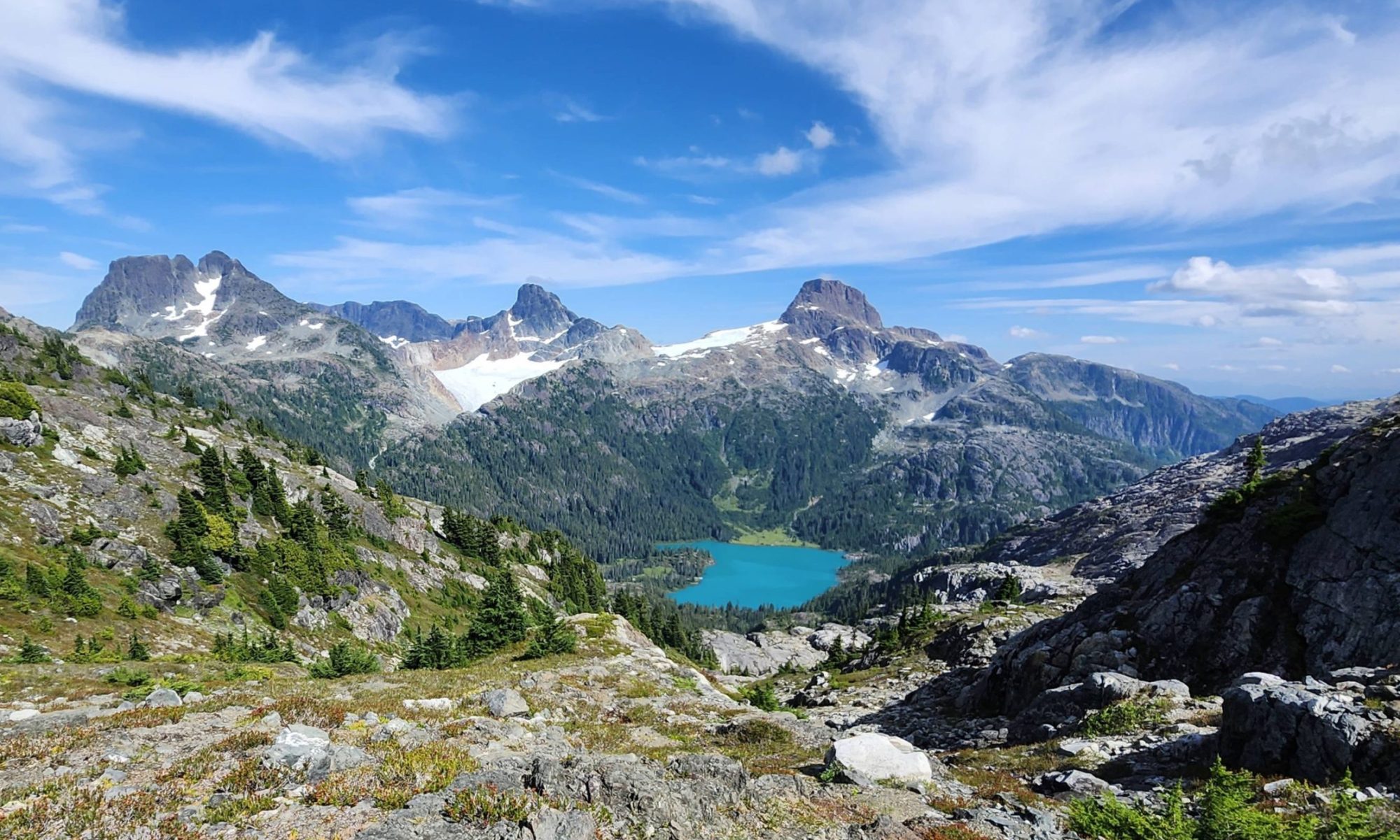
But taking notice of my accomplishments is the key to navigating through the sea of hopelessness, and that’s why I write these reports. On December 1, I was one of a group of six that summited Big Tree Peak in the Prince of Wales Range. The peak itself is hardly worth noting; it’s not the highest, bushiest, or most challenging, nor does it have the best view of all the peaks in the Range. However, it was the final peak I needed to summit in the range. And for that reason, it’s important to take note: I’m making progress.

Total Distance: 7.2 km
Starting Elevation: 789 m
Maximum Elevation: 1419 m
Total Elevation Gain: 724 m
Total Time: 4 hours, 43 minutes and 34 seconds


