Dover Bay Flores Island Backpacking Trip – June 24-26, 2015

On June 24, I led a group of 12 students, 2 grade 8’s, 7 grade 9’s, 2 grade 11’s, and 1 grade 12, to Flores Island, a 35 minute water-taxi ride from Tofino on Vancouver Island’s west coast.

The water-taxi ride over to Flores. 

After docking, we had a short walk through the Ahousaht Indian Reserve to the trailhead. 

Some of us at the trailhead, in a light drizzle. 

Hideki and Zack crossing one of the many beaches on our 11 k. hike to our campsite. 

Emma on some seaside scrambling. 

Brayden heading up one of the headland trails. 

Because it was a rising tide, I elected to take the notorious “Trail of Tears,” instead of taking
the short-cut across the river. The trail wasn’t made any more pleasant with the light drizzle that
drenched all the salal. 

The kids entertained themselves with games of concentration whenever the opportunity arose. 

Despite the soaked wood, the gang managed to get a fire going. 

Ah! Leigh with the no-bake cheesecake. I overhead one of the campers say she’d “never tasted anything as good!”

Jay putting the final touches to the cheesecake. 

Roasting smokies over the fire at Cow Bay.

The second day, Thursday, we headed off at about 9:30 on a hike up the coast, some drizzle again. 

Another game of concentration. 

Katie maneuvering through the rocks. 

Crossing Cow River. 

Some lovely seaside scrambling.

Fording another creek. 

Peter leading the way down the rocks. 

Beautiful shells along the way!

Leigh’s collection of shells. 

Heading back to camp. 

Collectiing firewood along the way back to camp. 

Sandrine and Melanie with some nimble moves across the creek. 

That’s a big piece of wood!

Back at camp a few of them braved the cold waters for a dip. 

A selfie on the rocks at camp. 

Harlequin ducks near camp. 

Making Jay into a “mermaid.”

Peter bites the sand. 

And then the sun finally came out!

The whole group. 

Heading back to Ahousaht on Friday. 

Fording the river so that we avoided the “Trail of Tears.”

Sunny, and becoming hot on Friday. 

Jay and David nearing Ahousaht. 

On the boat ride back. 

Tired campers!

But still having fun!

Klitsa Mountain

— Submitted by John Young
Had perfect weather for the June 20th Klitsa Mountain Hike, although the road couldn’t have been any dustier! Our three 4×4’s made it up as far as we could go on the old spur off of Nahmint Main, and our group of 9 started hiking at 9:40. After 1/2 hour walking up the washed-out road, we then entered the old growth on the Brook George trail. A beautiful walk through the forest, and then broke out of the trees after another 1/2 hour, and soon we had views of surrounding peaks, valleys, and lakes. We meandered our way up, reaching the summit about 1:40, where we sighted a ptarmigan. After a leisurely lunch, we started down, and spotted a grouse and chick, and reached the cars about 5 p.m. Great outing! 

Heather Mountain

— Submitted by Sherry Durnford

We  Left cars at foot of R spur at the end of Cowichan Lake at 8:30 am. The first 2 1/2 hours follows inactive logging roads, then a brief tangle on route with old logging slash to a subalpine pond. From there, it is a very pleasant 2 hour ramble up to the summit with profusion of alpine flowers, several grouse, tree frog, but no bears. We had great weather and a great group. We stand corrected that it was only 25 kilometers round trip and only 3100 vertical feet. Trip ended with a cool dip in Cowichan Lake and an ice cream stop.

A beautiful tarn on Heather Mountain

A great looking group of Nanaimo hikers

KeehaBay – June 3-5, 2015

I took a school group out to Keeha Bay last weekend, near Bamfield on the west coast of Vancouver Island. I didn’t really know what to expect from the trail. In years past, it had taken up to 3 hours to slog the 4 k. through the mud, over and under the trees to the beach.   The beach didn’t disappoint, whales, although not too close, were feeding offshore, 4 bears were spotted, a weasel, eagles, and osprey.

Yes, even with the dry weather (5 mm of rain in May!) the trail was still wet and muddy!
 Some marine fog, but it burnt off Saturday afternoon, and then there was sun, too much!

 We arose early Saturday, 6 a.m.!, to go for a walk at low tide. 
 Some great caves!

 The whole group – 15 of us. Me, two parents, an adult older brother, 3 female recent graduates, and 8 students, one grade 12, four grade 9’s, and three grade 8’s, all boys. 

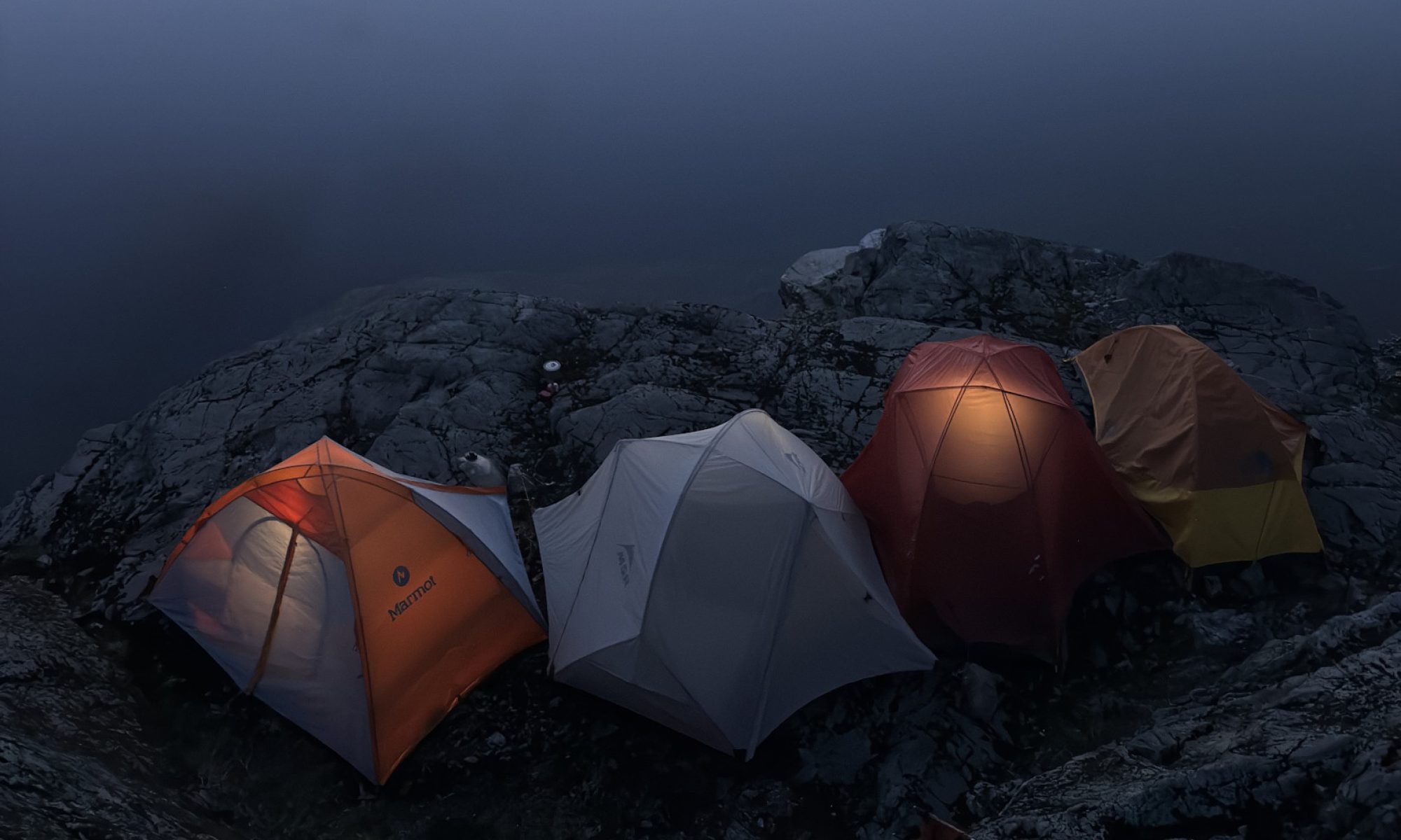
 A beautiful view from this rocky promontory. 
 Liam, one of the grade 8 boys, excitedly called to me to bring my camera over. 
At first glance I thought it was just a pile of seaweed.
 But upon closer inspection I realized Luke was buried underneath all that!
And was he ever shivering!

 David and Peter and Liam had fun playing Huck Finn.

 Beautiful Indian paintbrush!
 The older kids sensibly covered up from the sun.
 Ah! What a trip! 

Paradise Meadows to Wood Mountain — A long established trail in Strathcona Park

— Submitted by Matthew Lettington

Strathcona Park is loved by many for the diversity in mountaineering it offers. It has something for every type of adventurer: short & long day trips, traditional routes, climbing,  and mountaineering. If one is looking for adventure in the Alpine they can find it here.

Several of the hikers crossing one of the water crossing on the Paradise Meadows to Wood Mountain Route
Hikers crossing crossing a creek  on the Paradise Meadows to Wood Mountain Route

Sunday May 14th I led a group of 9 Island Mountain Ramblers and guests on a long day hike through a portion of Strathcona. We hiked from Paradise Meadows, starting at Raven Lodge through the rolling low alpine meadows, beside many ponds and lakes and lightly treed regions to Wood Mountain, frequently called the Forbidden Plateau.  Paradise Meadows is by far one of the most visited places in the park. It is the launching point for many day hike and multi day adventures. Many hikers will be familiar with the Wood Mountain/Forbidden Plateau Parking Lot as it is the usual launch point for hiking Mount Becher, Boston Ridge, Mount Drabble and more.

Map from Paradise Meadows to Wood Mountain
GPS Route to Wood Mountain with Photographs

Total Distance: 26 km
Total Elevation Gain: 730 m
Total Time: 8 hours

This is my third hike on this route but the first time I appreciated the historic nature of the hike. The hiking club to which I belong, Island Mountain Ramblers, have a lifetime objective hike that I’ve yet to complete, Mount Becher to Mount Jutland and much of the day’s route is included in this section of the trail. I suspect the objective has a lot to do with the fact the trail was the main route to the region of the park where, now, many people adventure to familiar mountains like Mount Albert-Edward.

View the full report on his blog…

Lee Plateau

— Submitted by Ken Rodonets


A sparse few hikers joined the Capes Lake hike.  Instead of going to the lake we went straight up the ridge to Lee Plateau. We had lunch, took some pictures and came back down.  We traveled 4.5 kms uphill, and then 4.5 kms downhill.  The day was just right, not to hot, not to cold. This is a very steep hike, you need at least 2 liters of water.  No snow around the 1, 250 meter level.

Keeha Bay & Meeting my Hero

–Submitted by Matthew Lettington

Hemingway assisting in raising the tent at Keeha Bay

Victoria Day, May long weekend, or May-long, no matter which you call it it’s one of the best weekends for camping! It hardly matters if it rains or shines, its a symbol of transition out of the long wet winter and spring to the long awaited  summer. The past few years I have marked this transition by hitting the beaches of Vancouver Island, hiking the plethora of coastal hikes available to us.

This year, I led a a group of Island Mountain Ramblers and my family, nine people in total to the aggregate sand beach of Keeha Bay. Located in the Pacific Rim National Park. Keeha Bay is near to the northern trailhead for the West Coast Trail, close to Pacheena Bay. Unlike the West Coast Trail, the Keeha Bay Trail receives very little official maintenance, has very little elevation gain and is one of the shortest trail hikes to the gorgeous beach, which is not often visited. Sounds pretty amazing right!? Wrong! In actual fact the trail is the muddiest I’ve ever hiked and has a large number of technical challenges that make the short distance a lengthy to hike.

Read the full report on his blog….

Maple Mountain and Samsun Narrows

— Submitted by Ken Warren
Four Island Mountain Ramblers started our Maple Mountain hike on May 9th from Chilco Road in Crofton.  We were the only vehicles parked on the street and the weather was clear and warm.  The trail starts gently and gradually gets steeper, although it never gets very steep or particularly difficult.   Weaving among the fir and cedars of the Blue Trail we emerged onto bluffs several times to northward views of Georgia Strait and the Coast Mountains  with the ferry plying its way from Vesuvius to Crofton.  Turning south on an unmapped but flagged extension of the Pink Trail we made our way up to the summit and had a well-deserved snack among the arbutus and oak with views of Maple Bay, Tzouhalem, and the southern part of Saltspring.
Lunchtime
 

We descended heading west on the Pink Trail with some great views of Sansum Narrows and down through some  large old-growth fir and red cedar.  As we got closer to the water Garry oak and arbutus took over and the blue camas and death camas , with sea blush and spring gold became more common.  Along the Blue and Yellow Trails we were always in sight of the narrows and marine traffic.  I looked for cactus, which I have seen before, with no luck.  We took a break at Grave Point watching  a seal watching us and enjoyed the marine action.  It’s a busy spot.
 
We completed our last leg in the sun on a quiet trail.  Although it is one of the most accessible mountain and marine trails on Vancouver Island we only saw four people all day.

Mt Tzouhalem — Hike & Flower Hunt

–Submitted by John Young

Another lovely jaunt up beautiful Mt. Tzouhalem. Picturesque clouds in the morning, and then cleared off, and warmed up in the afternoon. Spent a little extra time wandering around the bike trails, making it a 6 hour outing, including many breaks. Many other people up at the cross enjoying the great view. Some flowers out, and fresh growth on the Garry Oak was beautiful. 

Mt Cokely to Base of Mt Arrowsmith Gully

— Submitted by Clark Gourlay,

— Author Wanda Hill

ACC combined with Island Mountain Ramblers trip Apr 25, 2015. Traverse Mt Cokely to the Base of Mt Arrowsmith Gully and hike out climbers trail to the road. Organized and let by our fearless leader Clarke. Particpants included Clarke, Roger, Peggy, Monica, Wendy, Sandra and Wanda. We arrived to find loads of fresh snow. The trip took us 8 1/2 hours using various combinations of snow shoes and crampons. Thanks to Roger for breaking trail most of the way and Clarke for the excellent route finding. This route was moderately strenuous with beautiful scenery and some short steep and airy sections.