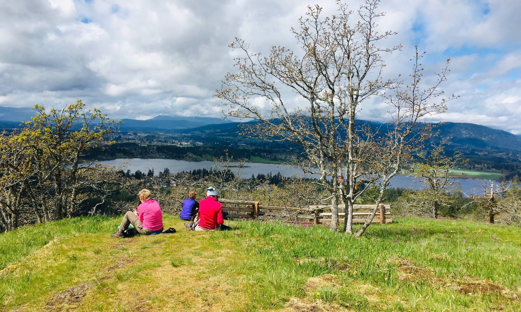
Mt. Tzouhalem Ridge and Flower Reserve

~ submitted by Mary Hof

April 17, 2019

Mt Tzouhalem ridge walk and flower reserve did not disappoint.

I was celebrating 25 years of hiking and belonging to the Cowichan hikers. Mt Tzouhalem was the first hike I did, and was also the first hike I led.

It was a great day for a hike. Thanks to Ronna for the many pictures. It was a wonderful day.

Mount Olsen

–submitted by Matthew Lettington; originally published on explorington.com

While some mountains are heinous bushwhacks, and others require long logging road approaches, Mount Olsen is none of these. All along the Corrigan Main the land is laid waste by heavy logging, and the myriad of logging roads crisscross the slope creating a maze of roads that push high up the side of the mountain. Although we came ready for a long slog along snow-covered roads, we discovered the roads clear; a benefit of an early spring heatwave.

one short butt slide

Mount Olsen Route

Total Distance: 5.9 km
Starting Elevation: 816 m
Maximum Elevation: 1293 m
Total Elevation Gain: 544 m
Total descent: 557 m
Total Time: 4 hours, 44 minutes
Continue reading “Mount Olsen”

Mt. Prevost

~ submitted by Mary Hof

March 23, 2019

Leading a hike is the easy part. Answering all the emails for weeks before, keeping track of the cancelations and additions, figuring out car-pooling, waivers forms, etc… are the hard things lol.

Fifteen hikers came out to the Mt Prevost Hike on March 23. We had 8 members and quite a few potential members. For me it is always a delight to lead, I enjoy meeting new people, and share our mountains with new people.

Continue reading “Mt. Prevost”

Gowlland Ramble

~ submitted by Mary Hof

March 10th, 2019

15 hikers came out March 10th for the Gowlland Tod Ramble Hike.

Half the hikers were Island Mountain Ramblers, others were from OCV, and Cowichan Hikers, all of which I am a member. It still amazing how much snow there still is on the hills, but we did see few flowers also coming out.

Continue reading “Gowlland Ramble”

Mt. Benson – Feb. 24, 2019

What a beautiful day!

On the summit with our adopted dog – he photobombed us!

Crossing Witchcraft Lake

A slippery trail on the bottom half

But after crossing the creek, we were soon wallowing in the snow

But some beautiful views and natural art

And wonderful snow!

A squirrel tried to break trail for us, but needs some work on that!

And we still broke trail on the old road

And even up the first part of Gordie’s Trail

It was slippery near the top

Approaching the summit

After basking in the sun, we slipped/slided our way down

And back to Witchcraft Lake

Mount Sir John : A First Winter Ascent

–Submitted by Matthew Lettington; originally posted on explorington.com

When it comes to ascending seldom-summited peaks, I’m often reticent when we depart the Jeep. So many questions about the route and what we will find ahead make me reflect inward. So, it’s probably no surprise that when winter’s snow and ice become part of the adventure, there is sometimes a certain amount of foot-dragging before we leave. That was indeed the case for our planned New Year’s Day ascent of Mount Sir John; we didn’t even make it to within six kilometres of the peak, calling off the trip before we had even put our boots on.

Hiking to Mount Sir John in the Franklin Range on Vancouver Island
Sasquatch – the elder

Distance: 11.0 km
Starting Elevation: 831 m
Maximum Elevation: 1443 m
Total Elevation Gain: 724 m
Total Time: 5 hours, 56 minutes


Continue reading “Mount Sir John : A First Winter Ascent”

Mount Tzouhalem

~ submitted by Mary Hof

January 13, 2019

16 hikers, 2 were members of the Ramblers and 2 were interested in us. The rest were Cowichan hikers, and with the beautiful weather and the route I choose, many wanted to join in. The hike was only 10k but had many view spots and was a wonderful day to be out. Thanks to all who joined.

The Hordelski – Mt Benson New Year

~submitted by Ken Warren

January 1, 2019

Twelve eager hikers set out earlyish new year’s morning to enjoy what’s become an annual hike and remembrance of Mike Hordelski.

The weather was ok with mixed cloud and sun with no wind. The evidence of our recent wind storm was most visible around Witchcraft Lake, and several trees have fallen since the big blow, so the ground is still saturated and caution needed. Most of us put on our traction aids around the third way mark and the trail was easily followed. We met no-one going up and the views at the lookouts were quite good. There was a lot of snow on the final third, but the trail was packed and the going was easy.

We had the summit to ourselves for 10 minutes before the rest of Nanaimo started to catch up. Conditions on top were good with some changing views. The coastal mountains were quite spectacular. The descent was uneventful and somewhat slowed by the number of people we met. We heard some very animated conversation below us at one point and a hiker explained that it was group of Brazilians in their first encounter with snow. We intended to pass by the 1942 plane crash site but windfallen trees have all but covered the wreckage.

It was a grand day and Mike would have enjoyed it. Thanks to all for the pleasure of your company.