We left Nanaimo at 7 am for Crest Mountain. Driving between the Beauforts and Bowser, the clouds and rain increased and we were doubting our choice. Approaching Campbell River the skies cleared and we were much happier with our decision.
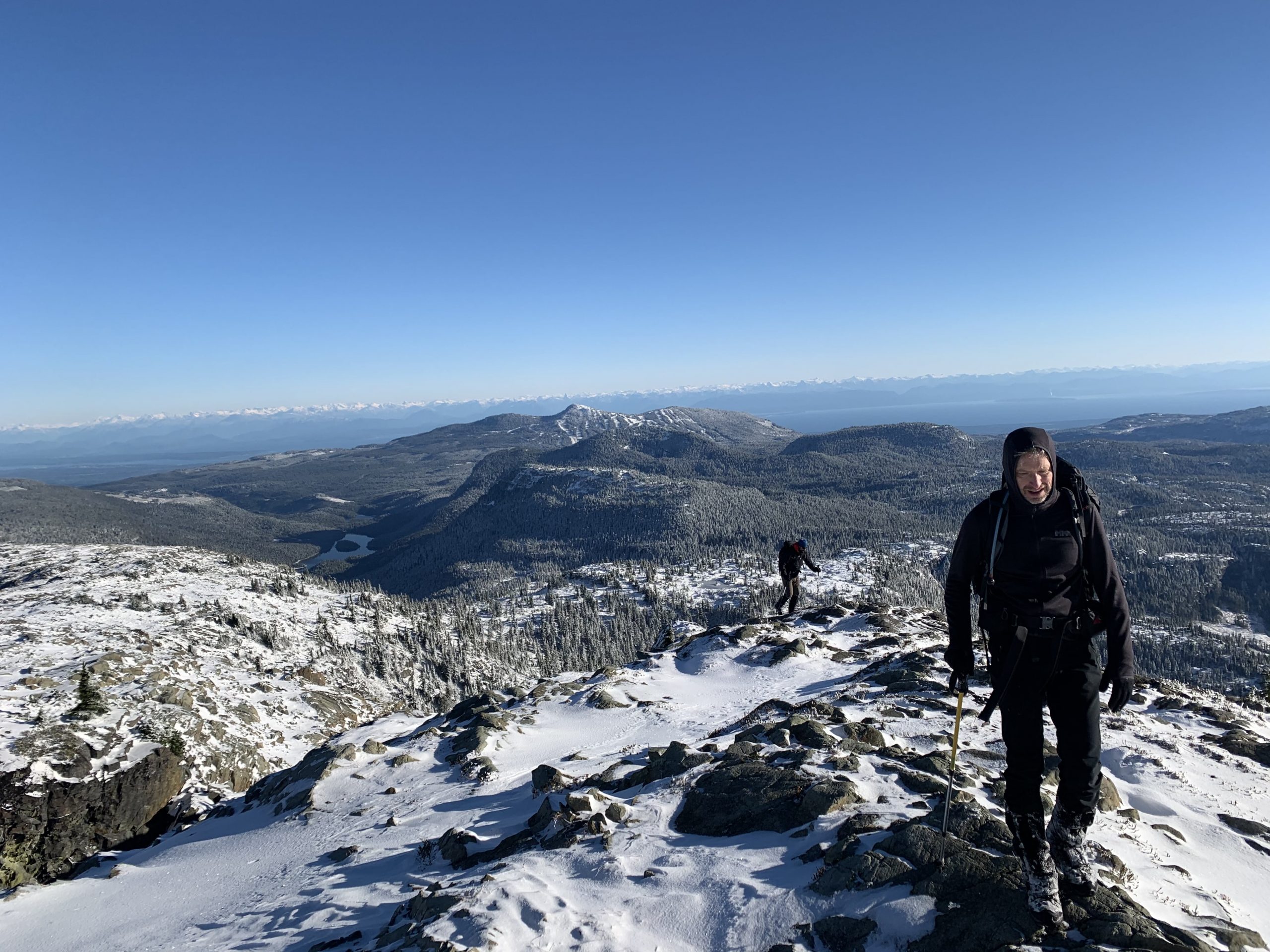
Mount Leiner is a surprisingly spectacular mountain. The most common approach begins on the outer edge of Tahsis, climbs Leiner’s southwest ridge and meanders several kilometres through the bush toward the summit. Considering its relatively low elevation, it holds a surprisingly high alpine character once you get beyond the shrubs.
The cirque south of Mount Leiner’s sub-peak, the lake is situated just above 1200 metres elevation
Leiner was a peak that we kept pushing off until “later”. But with an ever-shortening list of mountains remaining on our Island Alpine Quest, we’ve been faced with the reality that “later” is now. In Leiner’s case, we pushed it off because it’s located in Tahsis, making it too long a drive, and we had too many questions about a longer route to make it doable in a day. Heck! After we posted the trip to the Island Mountian Rambler’s schedule, Tahsis’ mayor reached out to warn us that he took three days to reach the summit and back. Obviously not a good omen, but along with his warning, we got a hot tip: A nearby logging road cuts as much as 5 km into the Leiner River valley – food for thought?
Mount Leiner Route
Total Distance: 8 km Starting Elevation: 686 m Maximum Elevation: 1468 m Total Elevation Gain: 1086 m Total Time: 7 hours
And so it was that on July 4, three adventuresome souls faced stifling heat and humidity, flies and bush, all in the name of tending to unfinished business: A successful summit of Volcano Peak.
A few patches of shrubs to wade through
Back before the year that never was, before anyone had heard the word COVID-19, Matthew, Phil and Karl completed a traverse of Wolf and Puzzle Mountains. On that trip, they wisely left Volcano for another day due to impending inclement weather. (Read More Here). Since that day in June 2019, the three mused about what it would take to return and tackle the the one we left unsummited.
Approach to the summit massif
Distance: 23.5 km
Starting Elevation: 262 m
Maximum Elevation: 1672 m
Total Elevation Gain: 1700 m
Total Time: 12 h
The logistics of this trip demand vehicle shuttles or two groups, each starting at opposite ends. With John Young leading (and planning) it is a simple task to co-lead from the opposite end.
With our trip planned to start at the Wood Mountain trail head and John’s trip to start at the Mt Washington trail head all participants met at Piercy Road at 08.00 for a vehicle swap – a great plan by John as it put each of our respective vehicles at the place where we would end the day.
A quick drive to the TH and we were off by 08.40. The direct route up from the parking lot through the old ski hill area is a fine, and hearth thumping, way to “warm up”. There was some good natured commentary about how much longer it would take John’s group to warm up on the flatter Paradise Meadows trails but we looked forward to end with a good leg stretch on kind trails.
John Young led the August rendition of the Augerpoint traverse, but as there were so many people interested, Greg Deabler, a very experienced mountaineer and fairly new Rambler member, was recruited to put on another trip in September. After cancellations and injuries, the group was down to six, but what a fine mix of six were we!
Planned as a do-over of an unsuccessful trip in 2018 this trip filled up quickly when posted on the schedule. By the time the week of the trip arrived the group reduced to just Gord and I. Leaving Nanaimo at 06.30 on Saturday we arrived at the trailhead at 09.00 and were set up in the lower meadows 3-1/2 hours later.
What a difference a year makes! Last year when we hiked this trail, we saw nary a soul past Mount Albert Edward, but this year we met more than 20 others. One big group of about 20, a group of 3, a solo man and his dog, and two runners completing it in a day. The trail is also much better defined than it was just last year – a well-worn tread with many cairns leads the way. Although it is popular and pleasant, it’s far from a “walk in the park,” as over it’s 30 km it gains 2150 m and loses 3000 m. Lots of ups and downs! Since we started from Mt. Washington’s Raven Lodge with an elevation of 1100 m., we had an overall elevation loss of 850 m.
We started off with a stroll through Paradise Meadows
In the fall I posted a July trip to the Hinde. Greg Deabler offered to co-lead, which made the thing possible. Even with that much lead time, and even if Covid hadn’t interrupted hiking, I’d have trouble preparing to lead that serious a trip. Later a suggestion was made to change the plan to a traverse. John Young would lead a traverse from Elk River to Buttle Lake, ascending the Hinde along the way, and our group would do the same in the other direction. We conferred with those who were down for the trip that was originally planned and the decision was a “go”.
As it turned out, we didn’t complete our objectives but it was a great time in the mountains.