Plan B – Pinder Peak

— submitted by Phil Jackson

Originally we were going to climb Big Interior Mountain, but after watching the weather forecast and
seeing that 1 meter or more snow was going to fall we decided to look further afield for somewhere the storm wasn’t going to hit. Further north the weather was supposed to be much milder. We decided on Pinder Peak in the Province Range.

Pinder Peak approach map

Heading north we turned off at the Zeballos forestry service road, after 9km we turned right onto the Atluck mainline. We came upon one of the most strikingly beautiful lakes on the island, Atluck Lake. After spending some time photographing the lake we carried on to the end of the lake where we turned left onto Artlish main and carried on for a further 4 km tim we came upon the deactivated spur road we were looking for. We hiked up the road to an elevation of 770m and set up camp.

Being as it was only 11:30 we decide to attempt the summit while the weather was good. Heading up through B1/2 bush we came upon a cliff band at approximately 1050m. To our left was a gully that had a raging creek and to the right difficult ground and a flagged route up to the ridge above us. This is also where we hit the first snow. The hike beyond is relatively easy ground. However is was dampened by meter deep powder snow, it  didn’t support weight. Around the same time the weather took a turn for the worst.

By the time we approached the summit we had less than 20m visibility and it was starting to snow quite hard. Reaching our agreed upon turn around time we beat a hasty retreat and arrived back at camp just as it got dark. As it was raining hard and realizing that a summit attempt the next morning was now out of the question, we quickly packed up and headed down to the car using headlamps to see.

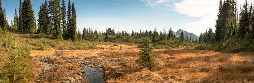
This is a very beautiful area with incredible views of both sides of the island with really good road
access and worthy of a visit


See full album of images.

Mount Wesley, high above the clouds

–Submitted by Dean Williams


We had a really nice day for a hike, with no wind, and once we got above the cloud cover it was brilliant sunshine and warm temperatures. John was even down to wearing shorts and a T-shirt, but he spent a lot of years living in Calgary.  It was one of the more interesting views i have had from the lunch spot, with low clouds below as far as the eye could see, with the ridges and peaks poking through, even down to Mt Baker. Another great outing on Vancouver island!


Springer Peak

–submitted by Matthew Lettington read the full report on his blog Boring Art, Boring Life

The many peaks in the Prince of Whales Range feature some of the greatest views of the Johnstone Strait; the distant peaks to both the east and west aren’t too hard on the eyes either. If you haven’t had a chance to hike in the region yet, I urge you to throw on some boots and head for the hills! My first hikes in the area were only this past summer, first when Phil and I hiked Mount Kitchener, and then when Phil led an Island Mountain Ramblers hike up the Stowe Creek Trail to H’Kusam Mountain. Having enjoyed these hikes, we eagerly planned to do another; we even entertained the idea of summiting Springer Peak and Stowe Peak in the same day. Ultimately, however, we would only achieve the first peak; conditions were wintery, and even at the lower elevations frozen ground made progress slow and dangerous.

approaching the final pitch tot he summit of Springer Peak

Springer Peak Map and GPS route

Total Distance: 9.7 km
Starting Elevation: 46m
Maximum Elevation: 1604 m
Total Elevation Gain: 1558m
Time: 6 hours 50 minutes

Trail conditions were surprising. We anticipated a trail similar to that of the Stowe Creek Trail, but the two were nothing alike. Although Bill’s Trail is very wide and easy to traverse, it terminates around 1000 metres and transitions into the more traditional Vancouver Island mountaineering route: up and over rocks, through steep sections of moderately exposed forest, and featuring several viewpoints. This transition turned me into a liar! In my trip description, I classed the hike as steep Class 2, obviously underclassed. Bill’s Trail leads from Seaward to the col between Stowe Peak and H’Kusam Mountain. The trail is notoriously used in the H’Kusam Klimb, and the event produces a great map with many features marked.

Read the full report on his blog Boring Art, Boring Life

Gemini Mountain — redux of the week before

–Submitted by Rod Szasz
–Photographs take by Maryann Wiggle


A group of six members ascended and climbed both peaks of Gemini Mountain, a mountain totally within the Nanaimo River watershed. The goal was to reprise a route taken the week before in foggy, drizzle where nothing could be seen. It was expected that views would be good and they did not disappoint .

The group comprised, Rod Szasz, Dean Williams, Rick Bronson, Lisa Bee, Deborah Blum and Maryanne Wiggle. Taking the traditional access to Green Mountain we ascended the road to the pass between the two peaks and parked. We entered beautiful first growth forest immediately with the goal of an ascending traverse to the notch between the North and South peaks of Gemini. The notch has some good Krumholz features and is relatively flat once it is reached about 300 metres above our starting place. From here it was more or less open and nice walking. After a more steep ascent we reached the open South summit and signed into the summit register we established in a cairn the week before. The summit and the cairn are on the northern boundary of the Haley Lake Marmot reserve. We did not enter the reserve.

From the South Summit we descended and then after climbing over a bump in the middle of the notch we ascended directly through good forest and elk trails the main and more frequented North Summit. There is no cairn here but two rocks on the highest point, a boulder on the summit. The South summit has had some trees cut on the south side to remediate the environment for marmots. We saw some older marmot dens, but nothing recent. Both North and South summits are broad and expansive with bluff bands breaking away offering unrestricted views.

This is only a moderate hike, but there is no trail and only a little flagging leading to the Northern, closest peak of the twins. This flagging is old and disappears rather soon, you cannot rely upon it. The Northern peak is 1518 metres and Southern summit at 1528 metres is only about 10 metres short of Mt. Whymper. People climbing this peak should be prepared and have experience with route finding. Use of GPS,  map and compass in proper combination is de rigour (and know that a GPS can never totally substitute map and compass).

Highlights of the trip were the views, numerous mushroom species seemingly everywhere, elk sign, groves of mountain hemlock and fairy-like glens, open forest and good conversation. We saw much elk sign, some low deer rubbings and some older bear scat. Total time hiking was only 4 hours at a moderate pace. Total up and down, around 500 metres.

 The area of Nanaimo Watershed and its peaks used to be frequented very often by Ramblers in the past. Changes of land ownership and active logging have lead to restriction of access to limit liability and vandalism. There was no evidence of anyone frequenting this area and the South Peak is really bereft of any human sign- my guess would be that less than 50 people summit the North Summit and around 10-20 for the South Summit on any given year. The roads are open to hunters and hikers  from early September to the middle of December for hunting season and hikers can also take advantage of this to reach the high areas as well. Although hunters were passed in their vehicles we have never encountered any once in the old-growth forest. As a matter of prudence, if we see hunters where we are hiking we usually stop and offer then a greeting and let them know where we are planning to be.

Queen Peak

— Submitted by Matthew Lettington — Read the full report on his blog

Queen Peak (Sutton Range) sits well off the highway, easily accessed via the Seward Junction. The name of the peak often creates confusion with another Vancouver Island feature commonly referred to as Queen’s Face, part of the King’s Peak hike in Strathcona Park. Queen Peak offers a steep approach through logging slash and first-growth forest to reach a long low alpine ridge that leads to its summit, which provides one of the best views of Victoria and Warden Peaks.

Queen Peak Vancouver Island, Hiking Lettington
The view of the valley below

Anticipating a long drive from Nanaimo, our plan of attack included camping at the trailhead to give an early morning start. We left Nanaimo well after dark as I needed to tuck Hemingway into bed first. The four of us rendezvoused at Phil’s house before hitting the long road to Seward Junction. Our beta provided good directions to the trailhead. Though the road is in reasonable condition, we encountered several cross-ditches at the upper elevations. Twice the passengers vacated the car to give enough clearance to get through the ditches and up the steep sections of hill. Once, they even pushed so I could get enough power to get up the hill; damned standards! All told, the drive took about four hours, including the long (more than 40 kilometres) logging road. It may have been faster had we travelled in daylight; the drive includes multiple turns on logging roads, and a few times we nearly took incorrect spurs.

Queen Peak Vancouver Island, Hiking Lettington
A late setup by car-lamp and an evening beverage before bed.
Queen Peak, Vancouver Island Map and GPS Route
Queen Peak GPS Route and Map with photographs

Total Horizontal Distance: 6 km
Starting Elevation: 700 m
Maximum Elevation: 1639 m
Elevation Gain: 972 m
Time: 6 hours 20 minutes

 High up on the logging road, at the start of our hiking route at 720 metres, we set up camp under clear skies. The stars shone bright, outlining the black silhouettes of the distant peaks. We shared a few beers before heading to bed. Though I slept well, I would be remiss in my friend-duties if I left out one detail: we camped near a trickling stream that created a significant amount of noise all night long. Though I didn’t have an issue, several of the hikers found sleep difficult, and made several trips to … water the forest.

–Read the full report on Matthew’s blog: Boring Art, Boring Life

El Capitan — Trail Clearning toward Lomas

-Submitted by Matthew Lettington


Recently, the Island Mountain Ramblers purchased a piece of trail-clearing equipment with the help of a grant from the Federation of Mountain Clubs of British Columbia. The club members had a busy summer, and September 25th was the first chance for us to get out as a club and use it.

GPS Route and Map with Photographs

Total Horizontal Distance: 20.8 km
Starting Elevation: 208 m
Maximum Elevation: 1210 m
Total Elevation Gain: 1051 m
Total Time: 7h 5m

 There are a lot of trails in need of maintenance. For our first effort, we chose to clear the Lomas Lake trail. In the summer of 2014, Sherry Durford led a club trip to the lake, and we noted that the trail was slightly overgrown. At the time, we discussed the need for trail maintenance; this was the impetus for us to submit the application for the grant. Our plan was to clear the trail to a point right before the final creek, and then search for a route to the col between Mount Service and El Capitan.

Read the full report on Matthew Lettington’s Blog, Boring Art, Boring Life

Mount Moriarty

-Submitted by Dean Williams

8 hikers set froth from Labour Day Lake to summit Mount Moriarty. It wasn’t the best day out
but not too bad, some horizontal sleet at the top, but we had a bit of a view
for a short time.  It was sunny on the peak by the time we got back down
to the lake. 

East Sooke Coast Trail –Lifetime Achievement Objective–

–Submitted by Phil Dol
East Sooke Regional Park offers 50 kms of trails through forest, marsh and field a Challenging 10 km Coast Trail, Pocket beaches, rocky bays and tide pools for exploring and scuba diving and Spectacular views of the Strait of Juan de Fuca and Olympic Mountains. This would be my third hike following the Coastal Trail from Pike Road to Aylard Farm. We started by making arrangements the day before with Sooke Harbour Taxi to pick us up at the Aylard Farm parking lot and drop us at the Pike Road trail head. 

We departed Parksville at7:00am Saturday in the darkness of the early morning not knowing what type of weather we would encounter today. When we were about 20 minutes from the Aylard parking lot we contacted the dispatcher for Sooke Harbour Taxi to confirm that we would be ready at our pre-arranged time for pickup. 
The day started out cool and overcast with a blanket of fog over the ocean blocking our view of the Olympic Mountains. The trail is fairly easy to follow with a well trodden path through the forested sections and reflective markers over the rocky areas, recently they have added colour trail maps at the major trail junctions as well as the existing wooden directional signs.

 We stopped for lunch at the Cabin Point Trap Shack, normally I would sit on the rocks and enjoy watching the waves move in and out over the tidal pools, but today we sat under the protection of the trap shack roof overhang from the light drizzle that had started about an hour earlier. This area is were you will usually start to see people on the trail. Along they way to our next stop at Beechy Head the sun decided to come out. From Beechy Head we continued past the Petroglyphs at Alldridge Point and to our final stop at Creyke Point to enjoy watching the sunlight start to diminish over the ocean before returning to the parking lot at Aylard Farm.
Along the trail we enjoyed the rugged coastal terrain views of Vancouver Island, multiple Heron sighting, a few Seals having a nap on the rocks, numerous Sea Gulls and a very vocal Squirrel. The trail is well maintained with lots of ups and downs, but no major elevation gain, also there are a few spots along the way that drop down to sea level. In total we hiked 13.5 km and took 7 hours with lunch and a few picture breaks.

6th Annual Fall Frolic — Ramble through Linley Valley

–Submitted by Matthew Lettington

The fall hiking season is well underway. The weekend of September 24th there were four events on the Island Mountain Ramblers’ schedule.

Saturday, John Young led a group of 6 Island Mountain Ramblers through Linley Valley.

The day was cool but nothing more than the dew of the early morning graced the hikers as they walked about 5 kilometres along the meandering trails. We visited Cottle Lake and two look outs before making our way back to the cars.

After the hike everyone feasted on the delicious fair brought be each hiker. Conversations ranged from what we were busy doing all summer to which hikes the club may put on in the future.

Mount Phillips via Arnica Lake

I’m using Island Alpine as a benchmark of mountaineering achievement, a checklist of mountains to summit. It mostly leads me to exciting adventures which I approach with anticipation, but every so often I find a hike where my expectations are low. Setting out to hike Mount Phillips in Strathcona Park is an example. In August 2013, I hiked the lengthy Phillips Ridge to the peak of Vancouver Island, The Golden Hinde. I assumed I would be hiking a well-booted trail through open terrain to a summit that many people regularly visit. The day would blow my expectations out to the water.

Mount Phillips, Strathcona Park, Vancouver Island, Map and GPS Route

GPS route with photographs in place

Total Distance: 29 km
Starting Elevation: 350 m
Maximum Elevation: 1722 m
Elevation Gain: 1900 m
Total Time: 9.5 hours

 Our new hiking tradition seems to be setting out well before dawn. On Sunday, October 18th, we set out from Phil’s house at 5:30 am, and arrived at the trailhead near the Nystar Mine not too long after sunrise. On the drive in we were mired in dense fog, but temperatures were warm, around 12 degrees, even before dawn. We were in for a cracker of a day!

-Read the full report on Matthew Lettington’s Blog: Boring Art, Boring Life