Lake Helen Mackenzie on a sunny day in February

–submitted by Matthew Lettington
Read the full report on his blog: Boring Art, Boring Life

Over the past two months, I have been working to build a pulk sled. I’m motivated by my dream of backpack-free winter camping (as I could haul my gear behind me on my snowshoe and backcountry ski tours), and by the weight of my son (as he just won’t stop growing). My first pulk sled had a high degree of success, but it also had some flaws. I learned a lot constructing Pulk Sled v.1.0.

Lake Helen Mackenzie in Strathcona Park on Vancouver Island
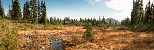
Hemingway cuts a trail on lake Helen Mackenzie

I went through at least four revisions on this first sled. My goal was to create a pulk that is easy to pull, easy to transport, easy to use in the field, protects the cargo, and maneuvers and tracks well.  Addressing the revisions, I altered the harness (how the stays connect to the harness); changed how the load in the sled is distributed; added stabilizers so the sled tracks better; and more. I found a great amount of success. In ideal conditions, Pulk v.1.0 works great. However, I hope to use the sled in conditions that are less than ideal.

Helen Mackenzie to Battleship Lake Loop GPS and Map
Helen Mackenzie Battleship Look Map

Total Distance: 8.0 km
Starting Elevation: 1042
Maximum Elevation: 1162
Total Elevation Gain: 250 m
Total Time: 4 hours

Family Day Weekend, Beginner Snowshoe

–submitted by Matthew Lettington
Read the full report on his blog: Boring Art, Boring Life

Family Day Weekend has come and gone, and I’m happy to say that I made the most of it. I planned three trips, including an overnight camp at a familiar trailhead in Seward. Don’t fret: I spent at least one of those days with my family! The first day was a beginner snowshoe trip to Lake Helen Mackenzie; Day Two, an intermediate snowshoe trip to Mount Allen Brooks; and the third, a more challenging trip to Stowe Peak, in the Prince of Wales Range.

Island Mountain Ramblers, Snowshoe to Helen Mackenzie
everyone looking out for the littlest Rambler

On Saturday February 6th, eleven Island Mountain Ramblers headed out from Raven Lodge on an easy snowshoe trip to Lake Helen Mackenzie. Several guests joined us, including two of Kim’s long-time friends, Emhrys and Nichole.

Raven Lodge to Lake Helen Mackenzie snowshoe
Lake Helen Mackenzie Map with photographs

Total Distance: 6.8 km
Starting Elevation: 1068 m
Maximum Elevation: 1161 m
Total Elevation Gain: 178 m
Total Time: 4 hours 30 minutes

Mount Myra, a first attempt

–submitted by Matthew Lettington
Read the full report on his blog: Boring Art, Boring Life

Stonewalled, again! I’m getting tired of writing reports that end with a failed attempt on some peak or other. So far this winter we have been turned back on more than 4 different peaks! Mount Myra is the latest peak to turn us back and be added to the list.

Mount Myra in Strathcona Park
The long but quick road home. 

We expected good weather and we weren’t disappointed. Excellent visibility, cool temperatures, and light snow wouldn’t be the undoing of our attempt. An incredible accumulation of recent snow would accomplish that.

Mount Myra in Strathcona Park
Mount Myra Map and Photographs

Total Distance: 12.5 km
Starting Elevation: 331 m
Maximum Elevation: 1161 m
Total Elevation Gain: 926 m
Total Time: 8 hours

Read the full report on his blog: Boring Art, Boring Life

Simple Snowshoe around Lake Helen Mackenzie

–submitted by Matthew Lettington
Read the full report on his blog: Boring Art, Boring Life

Another beautiful day in the low alpine. On Saturday, January 30th, I led a small group of Island Mountain Ramblers, along with a special guest, on a trip through Paradise Meadows to Lake Helen Mackenzie and back. We had fine weather: a little sunshine, some light snow, and a clear view along our route.

Hiking Paradise Meadows in Strathcona Park, Battleship Loop

In late 2015, I built a pulk sled to use on my ski and snowshoe adventures. Its purpose is to carry gear and my little guy, Hemingway. Since building the sled I’ve made a number of modifications, attempting to improve performance. Hemi was in tow today as we made our way from Raven Lodge.

We left shortly after 10:00 am; we were in no hurry for this simple snowshoe to the lake and back. On our way to the lake, we followed the summer route from the lodge. Though the route is commonly traveled, the conditions vary. On this day, the route had icy patches with a few areas sloping off the booted track downhill. Unfortunately, the sled performed poorly in these short sections as I have yet to install stabilizing fins, or a skeg.

Helen Mackenzie – Battleship Lake route Map

Total distance: 8.4 km
Starting Elevation: 1072 m
Maximum Elevation: 1165 m
Total Elevation Gain: 214 m
Total Time: 4 hours

Read the full report on his blog: Boring Art, Boring Life

Clayoquot Plateau Bush Bash

–submitted by Matthew Lettington
Read the full report on his blog: Boring Art, Boring Life

Have you ever pushed through so much bush that it physically pains you, and causes emotional trauma to the degree that it haunts you for days? I have, and I recommend that every hiker/mountaineer does it at least a few times in their life. It gives you perspective: in some ways, it makes you enjoy an unimpeded trail that much more!

Lake at Clayoquot Plateau
Phil about to descend to the lake

Philip Stone dedicates a portion of his book Island Alpine (2003) to a series of Top Ten lists, including a section for the top ten bushwhacks. Since publication, the face of alpinism on Vancouver Island has changed. The rock hasn’t changed, but gear has improved, new logging roads have been punched through, many roads have grown over, some routes have been placed and others cleared. The Top Ten lists are still important, but at least a few of them need updating, and the list of Island bushwhacks is one of them.  Keep in mind that this is just one blogger’s opinion, but I think this route should be considered for the list.

On Sunday January 24th, Phil Jackson and I made a solid Rambler attempt to summit Steamboat Peak using a route named The Cavers Trail, a route set by Quagger sometime before 2003. I was warned about the route, which lies along Highway 4 and is filled with classic Highway 4 bush. True to the claim, I’ll testify that this route is filled with many sections of solid class 3/4 bush. This is the type that claws at you as you work your way through all manner of vegetation. It hooks gear and rips at your flesh. I made it through with only a dozen scratches on my hands and a few marks on my face.

Clayoquot Plateau lake Map and GPS Route
Clayoquot Plateau Lake Map and GPS Route with Photos

Total Distance: 9.3 km
Starting Elevation: 66 metres
Maximum Elevation: 883 m
Elevation Gain: 919 m
Total Time: 8 hours 15 minutes

Read the full report on his blog: Boring Art, Boring Life

Touring Mount Allan Brooks’ Glade

–Submitted by Matthew Lettington

Read the full report on his blog, Boring Art, Boring Life

Last year I purchased some used alpine touring ski gear, but with the terrible winter I didn’t use it. This winter, however, has been kind to us. Lovers of winter sports rejoice! Everyone is dusting off their far-too-seldom-used gear to head into the backcountry.

Mount Allen Brooks, Skitourig Strathcona Park
John and Chris examining the route down

I planned an easy tour around Helen Mackenzie for Saturday, January 16th, intending to test out my gear. My boots needed some breaking in, and I needed to practice movement in walk mode with my skis. There would be plenty of practice, but we found more adventure than we originally intended.

Prepping at Raven Lodge
John and I traveled together and met Rod at Raven Lodge; he had bivyed overnight in Paradise Meadows. The sky was dark and the snow fell with the wind, blasting us in the face and pushing its way into the car when we opened the hatch. We gathered our gear and changed in the protection of Raven Lodge. As we dressed, we met up with a group of three more skiers from the ACCVI. Our groups had different agendas, but we were planning on travelling the same route. John, Rod, and I joined their trip up to the glades, the col between Mount Allan-Brooks and the Bump on the …..

Read the full report on his blog, Boring Art, Boring Life

Mount Drabble intermediate snowshoe

— Submitted by Matthew Lettington, read the full report on his blog Boring Art, Boring Life


A long time ago, when people were talking – for the first time – about a certain movie that took place in a galaxy far, far, away, there was an underutilized ski resort on a site which is now commonly referred to as “the old Forbidden Plateau ski hill”…
Bright and early on Sunday, January 10th, we were on the road, questing for adventure in Strathcona Park. Six of us made it to the trailhead for first light. The icy road and parking lot were plowed, making transit easy, but once we parked and exited, John’s truck slid a few inches. We took our first steps up to the proper snow of the old slopes at 8:00 am.

Hiking Mount Drabble, Strathcona Park
The gang rambling the rolling hills, approaching the summit of Mount Drabble
Mount Drabble Map and GPS route

Total Distance: 17.9
Starting Elevation: 713 m
Maximum Elevation: 1364 m
Elevation Gain: 1155 m
Time: 8 hours 15 min

Springer Peak

–submitted by Matthew Lettington read the full report on his blog Boring Art, Boring Life

The many peaks in the Prince of Whales Range feature some of the greatest views of the Johnstone Strait; the distant peaks to both the east and west aren’t too hard on the eyes either. If you haven’t had a chance to hike in the region yet, I urge you to throw on some boots and head for the hills! My first hikes in the area were only this past summer, first when Phil and I hiked Mount Kitchener, and then when Phil led an Island Mountain Ramblers hike up the Stowe Creek Trail to H’Kusam Mountain. Having enjoyed these hikes, we eagerly planned to do another; we even entertained the idea of summiting Springer Peak and Stowe Peak in the same day. Ultimately, however, we would only achieve the first peak; conditions were wintery, and even at the lower elevations frozen ground made progress slow and dangerous.

approaching the final pitch tot he summit of Springer Peak

Springer Peak Map and GPS route

Total Distance: 9.7 km
Starting Elevation: 46m
Maximum Elevation: 1604 m
Total Elevation Gain: 1558m
Time: 6 hours 50 minutes

Trail conditions were surprising. We anticipated a trail similar to that of the Stowe Creek Trail, but the two were nothing alike. Although Bill’s Trail is very wide and easy to traverse, it terminates around 1000 metres and transitions into the more traditional Vancouver Island mountaineering route: up and over rocks, through steep sections of moderately exposed forest, and featuring several viewpoints. This transition turned me into a liar! In my trip description, I classed the hike as steep Class 2, obviously underclassed. Bill’s Trail leads from Seaward to the col between Stowe Peak and H’Kusam Mountain. The trail is notoriously used in the H’Kusam Klimb, and the event produces a great map with many features marked.

Read the full report on his blog Boring Art, Boring Life

Mount Phillips via Arnica Lake

I’m using Island Alpine as a benchmark of mountaineering achievement, a checklist of mountains to summit. It mostly leads me to exciting adventures which I approach with anticipation, but every so often I find a hike where my expectations are low. Setting out to hike Mount Phillips in Strathcona Park is an example. In August 2013, I hiked the lengthy Phillips Ridge to the peak of Vancouver Island, The Golden Hinde. I assumed I would be hiking a well-booted trail through open terrain to a summit that many people regularly visit. The day would blow my expectations out to the water.

Mount Phillips, Strathcona Park, Vancouver Island, Map and GPS Route

GPS route with photographs in place

Total Distance: 29 km
Starting Elevation: 350 m
Maximum Elevation: 1722 m
Elevation Gain: 1900 m
Total Time: 9.5 hours

 Our new hiking tradition seems to be setting out well before dawn. On Sunday, October 18th, we set out from Phil’s house at 5:30 am, and arrived at the trailhead near the Nystar Mine not too long after sunrise. On the drive in we were mired in dense fog, but temperatures were warm, around 12 degrees, even before dawn. We were in for a cracker of a day!

-Read the full report on Matthew Lettington’s Blog: Boring Art, Boring Life

Mount Regan, via the Lower Route

–Submitted by Matthew Lettington, 

Vancouver Island, home to forest giants and cold oceans is often overlooked for its alpine opportunities. A favourite feature of the high alpine is the chance to strap on crampons and walk the many pocket glaciers and snow fields. However, the changing environment means that glacier walking on Vancouver Island may have it’s days numbered. This year with the hot dry conditions, after a year of poor winter snow levels, the glacier ice melt is visible. I visited many mountains this summer and walked on a variety of these pocket glaciers, in all cases the blue ice was on the surface and melting away.

Hiking to Mount Regan
Mount Albert-Edward (left) and Mount Regan (Right)

September 13th, 2015 I was joined by Phil and two others on a day trip up Mount Regan. It’s Mount Albert-Edwards neglected little sister, sitting tucked in beside Albert-Edward. My readers may remember that I tried this trip earlier in the summer, but we took a detour when the weather didn’t cooperate. This time, the whether cooperated and we successfully reached our goal, experienced a few surprises along the way and despite a hair raising fall, had a great trip.

Mount Regan GPS Rout and Pictures

Horizontal Distance: 36 km
Starting Elevation: 1080 m
Maximum Elevation : 1969 m
Elevation Gain : 1949 m
Time: 14 h

Read the full report on his Blog: Boring Art, Boring Life