A Family Kayak Trip on Kennedy Lake

Victoria Day weekend, sometimes affectionately referred to as “May long weekend” or “May two-four”, is Vancouver Island’s unofficial kickoff to the summer camping season. Year after year, thousands of families pack up their cars and head for the backcountry. I loyally follow this tradition, and this year is no exception, as my family and I joined friends on a three-night kayak trip to Kennedy Lake.

GPS Route and Map

View the route and see where I took my photographs.

GPS Route

View the topographical map, annotated with photographs. Download available.

Click Me!

  • Connector.

    Horizontal Distance 39 km

  • Connector.

    Total Time: 4 days

As we were loading our gear on the lake shore, in the warm light of the setting sun, my mind drifted to considering the significance of this trip. It’s a reprisal of an excursion we made three years ago, a four-night dream trip on Kennedy Lake. That was Kim’s first multi-day trip, and it was also our last multiday kayak trip before the arrival of Hemingway: Kim was five months pregnant at the time. It was an amazing journey, one that friends frequently talk about. Skipping forward to 2016, we paddled along in our Libra –a double kayak with a centre hatch. Kim paddled in the front, I in the back, and Hemingway, doing everything in his power to slow us down, in the middle. We paddled with the same group of friends, and this time Shawn’s adult daughter joined the fray. And yes, yet again, Kim is five months pregnant.

The first few strokes across Kennedy Lake on our May Long Weekend Kayak Trip

Lawlee Island’s rocky shore, shallow water, and dense bush were a welcome sight after the long drive from Nanaimo. As we paddled, Hemingway played in the kayak. He dipped his hand into the warmer-than-expected waters, and looked to the mountains that grow from Kennedy Lake’s shores. I could see his small chest rise as he tilted his head back and smelled the air. Kim asked what it smelled like, and he replied,“It smells like mountains”.“It smells like mountains”.

Kennedy Lake’s grand size allows for many coves, islets, and secret beaches worthy of exploring. It’s in these features that we hoped to find suitable camping before the sun set. A brisk westerly breeze gusted as we paddled; over the weekend we became quite familiar with it, as it gusted every afternoon and into the evening. Today it worked with us, giving a much-appreciated push on our way to Lawlee Island.

The family looking forward to the trip ahead on our kayaking trip on Kennedy Lake

“It smells like mountains.”Hemingway, age 2

The BC Backroad Map Book placed a camping marker on the northeast side of the island, and we expected to find a good site. What we found was a small space, suitable for a few kayaks, absolutely brimming with wood! We even had to move wood to make space for the tents. This is a harsh lesson about the book: it lacks detail. We were losing light, so we hauled our kayaks up the low angled shore, and rested them on the wood.

We quickly sorted camp, and prepared a light meal. Hemingway freely roamed the small beach, scrambling large boulders, tossing small rocks into the water, and smashing long section of branches. He discovered he could break the branches on large logs, and when he broke a cedar branch, he sniffed it and let out a small sigh of content. The night crept up on us: as the sun set behind the distant hills, the cold blue light of a nearly full moon illuminated the area, eliminating the need for a headlamp. As the stars appeared, Hemingway broke into “Twinkle, Twinkle, Little Star”. We sat up late into the night, listening to frogs and watching the stars: a great start to our adventure.

Hemingway sleeping in the kayak as we land on Lawlee Island
Hemingway exploring the rocks on Laylee Island, on Kennedy Lake

Our late night produced a late start on Day Two. We were in no hurry in the morning; we poked around camp and took our time loading the boats. As we finally set out on our way, the wind began to gather. We paddled the short distance to the western shore of Kennedy Lake. Protected from the wind, we admired the unkempt landscape, imagining a place where we could put in and climb a bushy route to the bluffs above. As we rounded a point, the wind hit us full force. It drove waves across the lake, crashing against the rocky shore and creating some intense cross-chop; the waves pearled over the bow of the kayak and into our hatches. Hemingway laughed, but I could hear the stress in Kim’s voice.

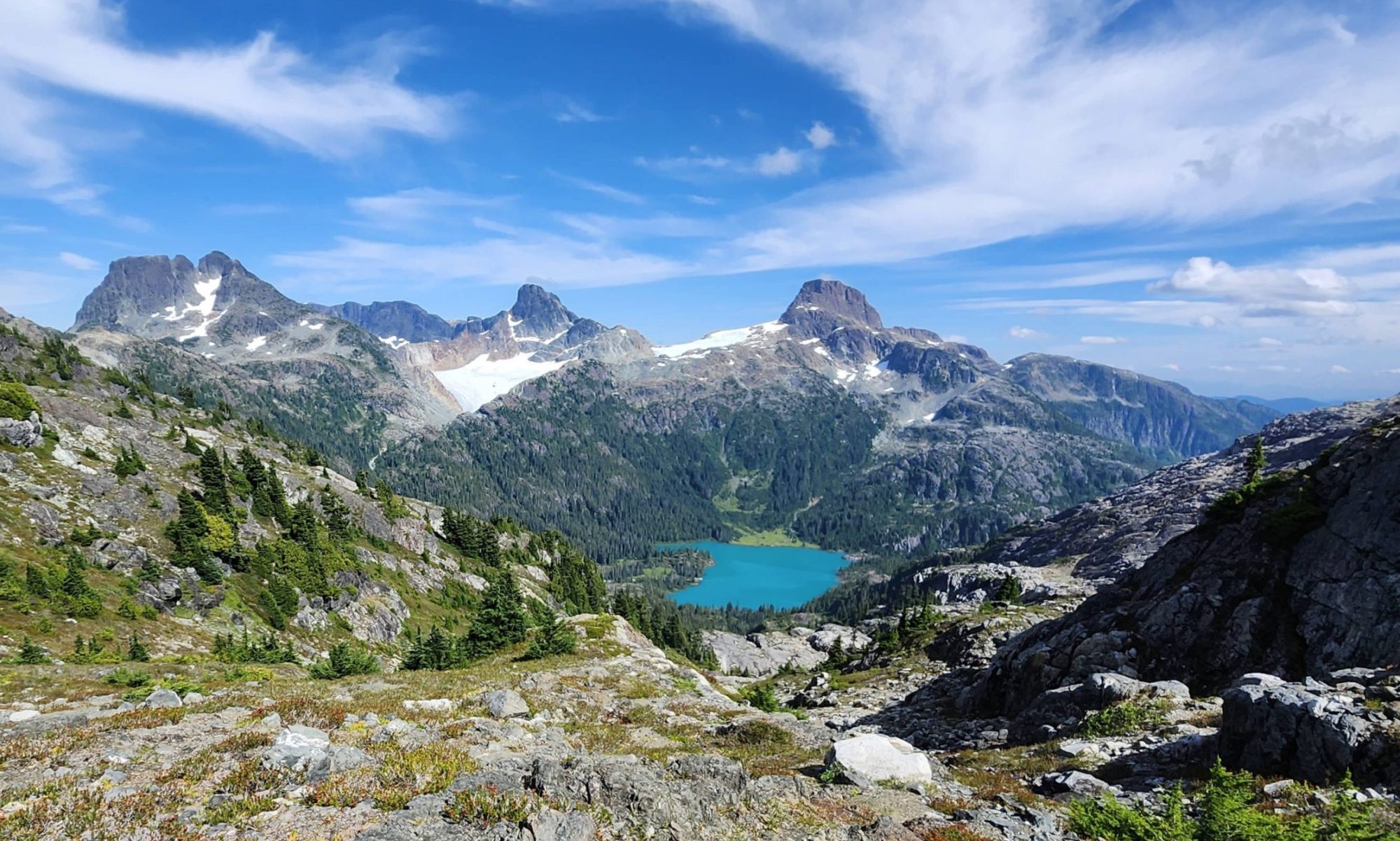
The distant peaks of the Maitland Range, emerging from the shores of Kennedy Lake

We pushed past the rough chop to the protected shore of a small provincial park, pulling our kayaks onto the low sloping gravel beach, and waited for Shawn and his daughter to catch up. As I explored the beach, I discovered a log with the name “Secret Beach” cut into it. It’s hard to believe this idyllic beach could be a secret! Mature forest backed the lovely beach, and just off the shore, a tiny islet enticed us to visit. The short three-kilometre paddle was exciting, and though we were tempted to paddle on, the sun shone bright, the beach drew us in, and none of us wanted to fight the wind.

We made camp and used the sunny afternoon to explore. Michael mostly explored the comfort of his hammock, and my family mostly played on the comfort of the beach. When we were too hot from the sun, we paddled the five minutes to the tiny island.

Michael relaxing in his hammockTime for an afternoon dip.
A view of the small island from our camp on Secret Beach on Kennedy Lake.Hemingway playing on the beach in the afternoon sun, on Kennedy Lake
On the small island just off the beach. lines of dried pollen creating stripes on the rocks.

On Day Three, we set out much earlier, in an attempt to beat the winds. We paddled the calm lake and peered through the shallow waters. We travelled a good distance, passing drive-in campsites, and around Agnes Island in the Clayoquot Plateau Provincial Park, up the Clayoquot arm of the lake. Predictably, the afternoon brought the winds; as Shawn’s daughter suffers from chronic pain related to an old injury, we chose to make camp along rough shores of Clayoquot Arm.

Michael paddling around Agnes Island, Kennedy Lake
Our lovely campsite on Kennedy Lake, day 3

We braved the jagged, rocky shore, in favour of the afternoon and evening rays of the sun. We set up camp, relaxed, went for walks, and, in the hot afternoon, swam in the cool, dark green waters of Kennedy Lake. I dragged Hemingway in with me as I swam—what a mistake! But, kids will always surprise you! When I tried to swim with him, he cried and wailed; but, when he threw three of his cars in the water in a fit of childishness, he entered of his own free will: it was a game for him. He demanded I go get them, but I refused. I told him, “You threw them in, you go get them!” To my surprise, he stripped his diaper off and waded naked into the water — the same water that he had WAILED and fought to keep out of. He wandered in up to his waist and bent over, even putting a portion of his head into the water to reach for the car. He did it! It was a big surprise to me, and even to himself. He had a huge smile on his face as he brought his car to shore.

As our last afternoon turned to night, I sat and reflected on the trip. Though we had not explored as much as I would have liked, nor did we visit our campsite from our first excursion on the lake, we did have an excellent trip. A lot happens in three years: sometimes, life kicks you in the gut. But I can’t let the good times be spoiled by the bad ones. My family is growing, and the bonds built between my family and friends is growing stronger. My friends stand by me, and I have the love of a three-year-old; at least for a few more years, his love is unwavering. I have to be grateful.

Read Michael’s report on his blog, and watch the video

 
Hemingway hasn't quite figured out the whole baby thing
 

Share this Post

About the Author

Explorington

Facebook Twitter Google+

Matthew is an adventure blogger and photographer. He documents his adventures on explorington.com. His stories create a vivid backdrop to give his photographs cotext.
He finds his adventures with the Island Mountain Ramblers, and whenever possible, his family joins his adventures.


The post A Family Kayak Trip on Kennedy Lake appeared first on Explorington.

Mount Tzouhalem – 04-24-16 -Island Mountain Ramblers’ Outing

A wonderful excursion on Mount Tzouhalem today. Although the forecast was for rain, the 13 of us lucked out and even enjoyed a little sun. A profusion of flowers – including shooting stars, sea blush, and camas. We spent a leisurely 10 minutes admiring the flowers in the reserve, and then wandered along the ridge to the cross, enjoying wonderful views along the way. Although the parking lot was full, we didn’t see many other people along the way. We had lunch near the summit, before heading down, taking a more inland route back to the car. A most enjoyable nearly three hour jaunt. 

The flower reserve.
Looking towards Duncan with Quamichan Lake down below. 
A profusion of camas!
Some downhill sections on the way to the cross and then the summit. 
The view from near the cross. 
Lunch time!

East Sooke Trail – April 2, 2016

What a beautiful trail!

Twelve of us met at Aylard Farm where we had two taxi-vans meet us and transport us to the trailhead at Pike Road. We started hiking under clear skies, but only 3 of us deemed it warm enough for shorts.

The short hike along Pike Road

After 20 minutes we came to Iron Mine Bay, and some of us donned more clothing to contend with the cool ocean breeze.

Meandering along the coastline trail

The brisk breeze kept the temperatures perfect for hiking, and we marvelled at the views of the Juan de Fuca Strait. I had only done this hike once previously, and had forgotten how rolling it is; you really have to be careful of your step going up and down the rocks! And the ocean is a long ways down from some of the precipitous cliffs!
Steep cliffs along the shore

Ah! It doesn’t get much better than this!
And the vistas never quit.

What beautiful scenery! (And I’m not talking about the hiker!)


We admired the view of the Olympic Peninsula Mountains across the strait.

And, after we passed cabin point, more flowers were blooming.

Shooting stars emerging early on the sun-soaked slopes.


Camus awaking early

As we neared Aylard Farm, we encountered more and more walkers, most without any packs, out for a short stroll. At the other end of the trail most of the people we saw were runners, but now they were walkers, many with dogs. Good to see many people out enjoying nature, and getting their kids out at an early age.  
The only thing I’m wondering is why did it take me 15 years to return to this gem of a trail!?


Mt. Arrowsmith Judge’s Route – New Year’s Day, 2016

We set out for the Mt. Arrowsmith climb, looking forward to the snow-covered slopes and the sunny, warm temperatures that were forecast; however, we were not sure about the road conditions, and soon after turning off the highway we had our answer: the road was icy! We inched along, and even at snail-like speeds I found my truck, 4×4 with snow tires, sliding sideways down the road. We therefore opted to park at the Pass Main Junction, rather than driving up to the usual parking spot for the Judge’s Route, adding about 45 min. of walking to our approach.

The 12 of us set off about 9 a.m., and reached the spur road about 9:45. Last year there was no snow on the spur; not the case this year!

We reached the trailhead about 10:15 and set off for the summit, agreeing on a “turn-around time” of 1 p.m. The trail up through the trees was quite well-trodden, as I was well back in our group, and two others had gone up ahead of us. Mike and Chris, two friends of mine, had had chains for their truck and had driven up to the parking lot, getting a head start on the rest of us.

Not an over-abundance of snow in the trees, but enough that we didn’t need crampons.

Before long, we were out of the trees and admiring the views and relishing the sunshine!

It was about 12:30 when most of us we reached this spot (although Tom and Paul were up ahead), still about an hour from the top. I, as leader, was thinking of just having lunch here and then heading down, but Monica and Ruth were game to keep going, so I figured we might as well see how far we could get by 1 p.m. And then, when our turn-around time came, I figured we probably had until 2 p.m. before we had to turn around, and we might as well go until we met Tom and Paul anyway. So, we kept going, and were just minutes from the top before we met Tom and Paul descending. So of course we weren’t going to stop then, and I’m sure glad we didn’t. A glorious view!

Monica nearing the summit. 

Ah! Almost there!

Doesn’t get much better than this!

And then, just before 2 p.m., we headed down. 


The snow had really softened up in the afternoon sun, but we made good time, reaching the trailhead about 3:45, with daylight to spare!

Amaru Zoologico, Cuenca, Ecuador

Today, I went to the zoo in Cuenca, and what a great experience it was! I took a taxi there, a 20 min. ride for $4 U.S. (that’s the currency here), and a bus back for 25c. Entrance fee was $6, and it took me four hours to make the tour. Granted, I took over 300 photos and read most of the signs, many of which were bilingual. Good for my emerging Spanish skills.

The zoo is a rescue center, and in this sign they outline the “sad pasts” of many of their clients, such as Pancha, the Mono Capuchino (capuchin monkey), who had been kept with a chain around his neck.

 I had forgotten the zoom for my DSLR, which was just as well as it was seldom needed. I did, though, have my little point-and-shoot with an 18x zoom which I used some. 
The zoo is like none other I’ve seen, as you can see in this image of the entrance ramp!

My favourite part of the zoo, apart from the lions being fed, was probably the aviary. There, I could get up close and personal with the exotic, colourful birds.

I also really enjoyed the monkeys, and some of the little ones had the run of the place.

I had bought a cup of fruit for lunch and set it down on the table when I went to take a picture of these two:

Then I heard some Ecuadorians laughing and turned around to see this little monkey had taken liberty with my fruit!

It was good to see, though, that even the monkeys who were caged had room to roam in passage-ways constructed out of chicken wire:

                                      The monkey enclosure:

There were also raptors in larger cages, 4 eagles in this cage. 

 And lots of other animals. 
A tigirillo (ocelot):

And here’s some of the rest:

But luckily, I came upon the exotic animal section just as they were feeding the lions. Eight of them, a mama and a papa, two cubs, and four youngsters. Papa let out a roar every now and then to let the little ones know that they weren’t getting any of his meat! The keeper told me that papa would eat all that meat in one sitting, and they are fed three times a day.

But the most beautiful creature had to be this peacock, and he seemed to be proud of it!

here

The view of Cuenca as I left the zoo. 

Hiking Flores Island – June 24-26, 2015

On June 24, I led 12 students and 2 adults to Flores Island, a 35 minute water-taxi ride from Tofino. The forecast was for light rain on Wed. and Thur., but I was hoping it would be wrong. We did start hiking in light rain, and it continued for most of the 4 1/2 hour, 11 k., hike from Ahousaht to Cow Bay, where we camped for 2 nights. Luckily, though, it rained little while we were in camp, and the kids managed to get a fire going, although it was a whole group effort! A wonderful trip, maybe my favourite spot on the west coast.

Hiking through the Ahousaht Indian Reserve after our water taxi ride. 
Crossing one of the many beaches en route to Cow Bay. 

But because it was a rising tide, we had to trek across the aptly named “Trail
of Tears,” rather than taking the low tide short-cut.

Despite the rain, though, the kids managed to get a fire going. 

On Thursday, we went for a stroll for a couple for hours along the coast. 

Lovely shells!

Fancy footwork across the Cow River. 

Lovely rocks, too!

A selfie on the rocks at Cow Bay.

Harlequin Ducks. 

And the sun came out!

Fording the river at low tide on the return hike on Friday, in sunshine@

The boat ride back to Tofino. 

Dover Bay Flores Island Backpacking Trip – June 24-26, 2015

On June 24, I led a group of 12 students, 2 grade 8’s, 7 grade 9’s, 2 grade 11’s, and 1 grade 12, to Flores Island, a 35 minute water-taxi ride from Tofino on Vancouver Island’s west coast.

The water-taxi ride over to Flores. 

After docking, we had a short walk through the Ahousaht Indian Reserve to the trailhead. 

Some of us at the trailhead, in a light drizzle. 

Hideki and Zack crossing one of the many beaches on our 11 k. hike to our campsite. 

Emma on some seaside scrambling. 

Brayden heading up one of the headland trails. 

Because it was a rising tide, I elected to take the notorious “Trail of Tears,” instead of taking
the short-cut across the river. The trail wasn’t made any more pleasant with the light drizzle that
drenched all the salal. 

The kids entertained themselves with games of concentration whenever the opportunity arose. 

Despite the soaked wood, the gang managed to get a fire going. 

Ah! Leigh with the no-bake cheesecake. I overhead one of the campers say she’d “never tasted anything as good!”

Jay putting the final touches to the cheesecake. 

Roasting smokies over the fire at Cow Bay.

The second day, Thursday, we headed off at about 9:30 on a hike up the coast, some drizzle again. 

Another game of concentration. 

Katie maneuvering through the rocks. 

Crossing Cow River. 

Some lovely seaside scrambling.

Fording another creek. 

Peter leading the way down the rocks. 

Beautiful shells along the way!

Leigh’s collection of shells. 

Heading back to camp. 

Collectiing firewood along the way back to camp. 

Sandrine and Melanie with some nimble moves across the creek. 

That’s a big piece of wood!

Back at camp a few of them braved the cold waters for a dip. 

A selfie on the rocks at camp. 

Harlequin ducks near camp. 

Making Jay into a “mermaid.”

Peter bites the sand. 

And then the sun finally came out!

The whole group. 

Heading back to Ahousaht on Friday. 

Fording the river so that we avoided the “Trail of Tears.”

Sunny, and becoming hot on Friday. 

Jay and David nearing Ahousaht. 

On the boat ride back. 

Tired campers!

But still having fun!

KeehaBay – June 3-5, 2015

I took a school group out to Keeha Bay last weekend, near Bamfield on the west coast of Vancouver Island. I didn’t really know what to expect from the trail. In years past, it had taken up to 3 hours to slog the 4 k. through the mud, over and under the trees to the beach.   The beach didn’t disappoint, whales, although not too close, were feeding offshore, 4 bears were spotted, a weasel, eagles, and osprey.

Yes, even with the dry weather (5 mm of rain in May!) the trail was still wet and muddy!
 Some marine fog, but it burnt off Saturday afternoon, and then there was sun, too much!

 We arose early Saturday, 6 a.m.!, to go for a walk at low tide. 
 Some great caves!

 The whole group – 15 of us. Me, two parents, an adult older brother, 3 female recent graduates, and 8 students, one grade 12, four grade 9’s, and three grade 8’s, all boys. 

 A beautiful view from this rocky promontory. 
 Liam, one of the grade 8 boys, excitedly called to me to bring my camera over. 
At first glance I thought it was just a pile of seaweed.
 But upon closer inspection I realized Luke was buried underneath all that!
And was he ever shivering!

 David and Peter and Liam had fun playing Huck Finn.

 Beautiful Indian paintbrush!
 The older kids sensibly covered up from the sun.
 Ah! What a trip! 

A country drive near Saskatoon, Part 2, July 4, 2010

While in Saskatoon, I went out with my dear old (with an emphasis on the old!) friend Frank Roy to take pictures. We chased and caught this rainbow, although my photo doesn’t do it justice.

A potash mine.
They don’t make clouds like that on the coast!
Posted by PicasaA yellow-headed blackbird. They were very plentiful this evening!