July 19th, another warm day to slog up Mt Prevost (Swuq’us).
There were seven of us between the Ramblers and OCV. At 9:00 am I left even though we were missing one but like I always say, 5 minutes early is on time, on time is late, and late is not acceptable.
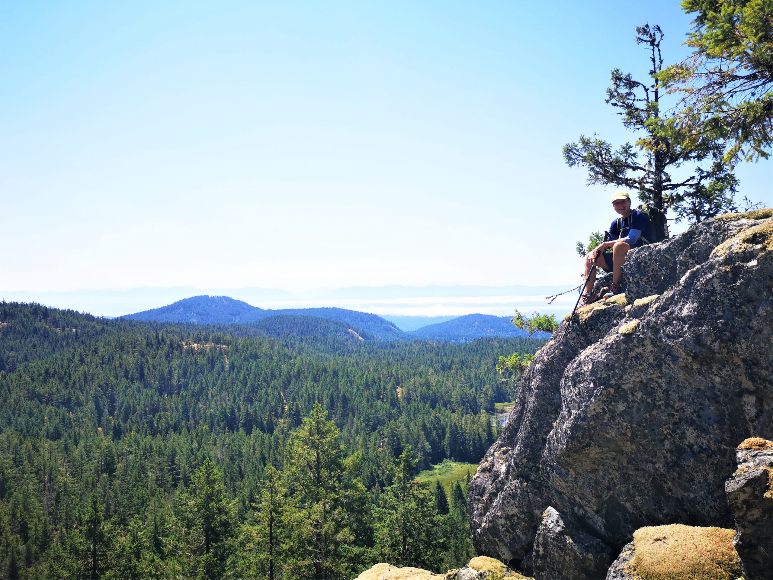
There are times when a mountain doesn’t quite measure up to one’s expectations. I’d pushed off an attempt on Hapush Mountain to the backburner in favour of other peaks on our list for several years. When Phil and Rick first did the Hapush, they recited nightmarish stories of bush and down climbs. Stories that were repeated whenever Hapush came up in conversation. It wasn’t one that I was rushing into.
Mount Cain Ski Lodge
But in July, when another friend successfully summited the peak and came back with a much better version of the story, I figured it was time to try her route to the summit – a route described by Tak O and Sandy B. I’m sure glad we did! I posted a trip to attract members who want to some more challenging terrain without the commitment of a huge day. It didn’t work out but we still had a great day!
Total Distance: 10 KM
Starting Elevation: 1140 m
Maximum Elevation: 1757 m
Total Elevation Gain: 800 m
Total Time: 4h 30 m
–submitted by Matthew Lettington –photography by Jes Garceau and Matthew Lettington
On Saturday, four of us braved the heat to learn the basics of rappelling.
The most challenging aspect of the day turned out to be dealing with the heat! The kids had a hard time managing their temperatures, but we were happy to take breaks in the shade of the Gary oak trees as needed.
And so it was that on July 4, three adventuresome souls faced stifling heat and humidity, flies and bush, all in the name of tending to unfinished business: A successful summit of Volcano Peak.
A few patches of shrubs to wade through
Back before the year that never was, before anyone had heard the word COVID-19, Matthew, Phil and Karl completed a traverse of Wolf and Puzzle Mountains. On that trip, they wisely left Volcano for another day due to impending inclement weather. (Read More Here). Since that day in June 2019, the three mused about what it would take to return and tackle the the one we left unsummited.
Approach to the summit massif
Distance: 23.5 km
Starting Elevation: 262 m
Maximum Elevation: 1672 m
Total Elevation Gain: 1700 m
Total Time: 12 h
It was a hot day to hike 16km, 850m elevation gain in the Sooke Hills Saturday, July 10th. Lead the hike for Island Mountain Ramblers and the Outdoor Club of Victoria.
We hiked from Charters River fish hatchery up Monument Mountain, had a well-deserved snack, and then headed to Grassy Lake, where the lilies were a spectacular sight. A quick break here and off to Mary’s Peak, 3 hours from when we started. A well-deserved lunch and I told them how I got a name on the map. I told them many years ago there was not much of a trail there, and at a difficult time in my life, I found peace there never seeing anyone there. After few times of going there, I mentioned to a few people how I just felt so good here, and the next thing I knew Mary’s Peak was on Open Street Map.
I have led many groups up here, and each time I am here a feeling of happiness comes to me, and I think everyone on the hike shared that happiness with me today.
After some pictures, we hiked back to Grassy Lake and heading down the Grassy Lake Trail back to our vehicle. It took us 6 hours.
It was good to share the day with so many that have never hiked here before, some that came from quite the distance. I have been leading hikes for over 25 years and I am always thankful to show people the beauty in every hike I lead.
Though we had a weekend-epic trip to the seldom summit Malaspina Peak, the west coast weather forecast proved too poor to warrant the long drive. In light of the island-wide forecast for rain –in varying amounts–, we changed our plan. Instead of the metal testing steep snow slopes, we opted for something local, Mount Benson.
Phil and I have done the east ridge route more times than I care to admit, throughout the pandemic. Our route covers 18 km and around 1050 metres of elevation gain. It’s a route that we can whip off in three to four hours. However, I’ve found that the metrics of elevation and distance matter only as much as the time you spend on your feet. In this way, I’ve found that a 7 hour day spent covering only a quarter of the distance and elevation can feel like just as much work as a quick rip up Benson. To make the day worth the trip for some of the folks travelling from up and down island, I proposed that we take our heavy backpacks to add in some conditioning!
So we each came to the hike according to what we wanted from the day. I brought a 45-pound backpack loaded with household cleaners and drywall mud, others brought heavier mountaineering gear, and still others did not even bring a backpack because they wanted to be out front being chased down by the three silly guys that thought it would be a great idea to hike with heavy backpacks.
All in all it was an expectedly fine day! Instead of blustery rain showers, we had glorious moments in the sun. We reached the summit in three hours and spend a fine break on the summit proper. We all took note that our location might have been the only location with the sun. As we looked out to Protection Island, Ladysmith and out toward the Nanaimo Lakes, we could see the showers dumping all around.
What a day! Our group of six enjoyed a fine day on Mount Benson.
We met at the Aylard Farm trailhead at 08:00 under somewhat promising skies and nearly ideal hiking temperatures. Depending on the weather forecast source, we were either in for a wet day, consistent with a “Bil Trip” as Mike points out, or a dry day and warming temperatures. We were not disappointed – were able to enjoy both forecasts throughout the day.