~ submitted by Matthew Lettington
Twelve members and guests made a quick loop around Lake Helen Makenzie and Battleship Lake.


Living the best adventure life, since 1958

Twelve members and guests made a quick loop around Lake Helen Makenzie and Battleship Lake.

January 4, 2020
~ submitted by Matthew Lettington
Our group of ten had a fantastic day on a leisurely trip up Mount Prevost. It was the kind of day that brought all the weathers: pouring rain on the drive in, cloudy on the way up, sunny upon reaching the summit but snowy as we departed, sunny back at the car, and then pouring rain on the drive out.


December 28, 2019
~ submitted by Matthew Lettington
In an attempt to blow out the holiday duff, twelve members headed out for a hike that the club hasn’t hosted since 2011, the upper portion of the Cowichan River. It was well worth the adventure!


~ submitted by Matthew Lettington
December 15, 2019
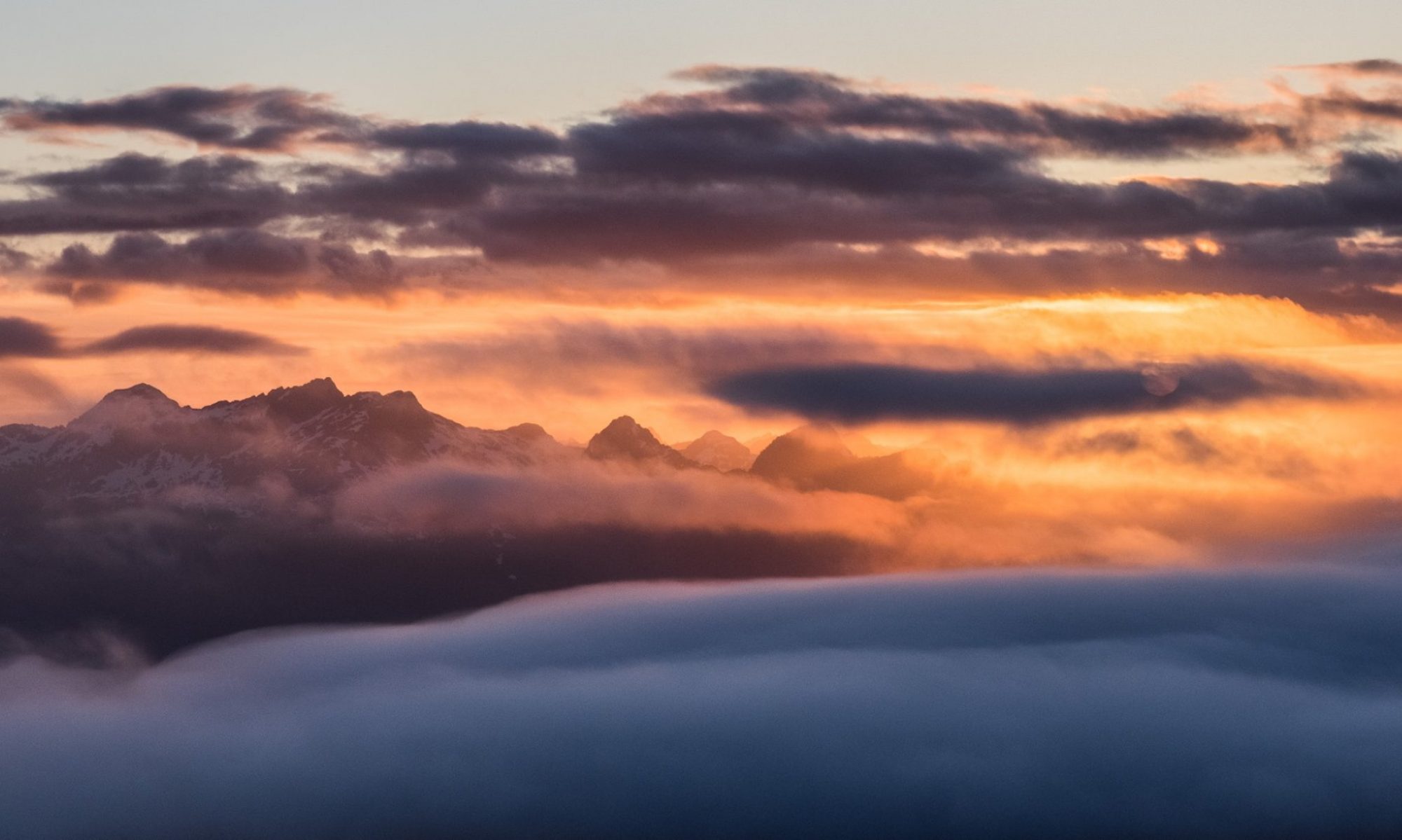
We pushed the limits of a B rating on our sunny, December trip along Wesley Ridge. We had an excellent day on the ridge. The leisurely pace helped with this as it allowed for in-depth conversation on a diverse range of topics.


The most challenging effort of the day was gaining the ridge. To ease the transition from sitting to hiking, we took our sweet time. Once we gained the hill, we found ourselves first walking in hoar frost, and eventually the lightest dusting of fresh snow. Though the first highpoint was mired in a fog that obscured any meaningful view, it didn’t last long. By the time we were halfway along our route, the cloud dissipated and the sun shone down.

Though it remained cold throughout the day, we kept ourselves warm by maintaining a consistent though relaxed pace to cover the 1000 meters of elevation gain and 14.4km.

So did we make it in under 6 hours? No, we needed an extra 15 minutes. We might have made the 6 hours mark but for the blowdown along the ridgetop and missteps at the very beginning of the day. I heard no complaints over the smiles on people’s faces as we finished up this Ridge Ramble!

October 27, 2019
~ submitted by Matthew Lettington
It was a horrible day for a club meeting. The sun was shining, birds singing, and a light breeze chilled the air to keep us from overheating.


Our group of seven spent a little over three hours exploring the first two ridges. By the time we arrived back at the parking lot, we had completed a 10.5 km loop with just about 400 meters elevation gain.


It was a perfect pre-meeting hike!

The Mount Benson Project continues to roll along. During the summer, we spent our time diverting water and shoring up the eroding bank. Since then, we have been reluctant to do any work that relies on the integrity of the work previously done. When the fall rains arrived, we examined the results of the work, and it appears that most of the water is being diverted off the trail. Though there is still more work to be done in this area, we are ready to move into some other areas of work.

On Wednesday, October 30, Dustin and Matthew loaded their backpacks and set out with adhesive, rebar, and hammer drill do work that added steps in a few key places within our section.

September 28, 2019
~ submitted by Matthew Lettington
On Saturday, October 28th, I led a group of 9 –including a 13-month-old—to the summit of Mount Apps. The sun may have been shining but that did not offer much reprieve from the biting cold and bitter wind.
Continue reading “Mount Apps from Buckley Bay Side”
Our late September trip to Pinder Peak was fantastic! The combination of a dry, cool day on a snow-free route filled with plenty of alpine berries reminded me why I (sometimes) love fall hiking! This trip was very different from my first trip to Pinder Peak.

If you’ve ever driven along by Atluk Lake, you’ve probably spotted the Pinder massif out your window. It rises from the wooded shores of the lake as a rocky tower that begs the mountaineer to climb it. The summit massif is marked by two prominent features, either of which is a worthy objective, though the subpeak is probably more of a challenge.

Total Distance: 14.0 km
Starting Elevation: 360 m
Maximum Elevation: 1550 m
Total Elevation Gain: 1223 m
Total Time: 7 hours

September 11, 2019
~ submitted by Matthew Lettington
That moment when you stand on the end of a cliff, a rope both ahead of you and dangling over the cliff, when you make the conscious decision to step over the edge is the hardest. If it’s your first time or the 100th time rappelling down a rock face, it’s a thrilling feeling.


My summers are hectic. I pack my days full of hiking in the mountains and coasts of the island. Often, I’m thinking about what to pack on my next trip while I’m unpacking my gear from a trip I’ve just finished. So come September, I’m ready to head back to work and the normalcy of weekly routines that it brings. But not before I squeeze in one last hurrah, on Labour Day. This year, we picked Marble Meadows as the destination for the weekend, and it didn’t disappoint. It was just what I needed after a summer of rained-out trips and the loss of a friend on a mountaineering trip.

Marble Meadows is a unique treasure within the boundary of Strathcona Provincial Park. But before you start shouting, “Uh, Matthew, there are many treasures in the park!”, let me qualify my point. It’s one of the few places you can stand on the top of a mountain and see exclusively unlogged landscapes, turquoise lakes, and the many types of rock found on the island. It’s a backcountry destination well-known by hikers and fossil-hunters for its rolling terrain, well-booted track, and the millions of fossils visible on the surface of the exposed limestone. You get the point: Marble Meadows is worth a special note.
Total Distance: 30.4 km
Minimum Elevation: 227 m
Maximum Elevation: 2079 m
Total Elevation Gain: 3012 m
Continue reading “Marble Meadows Ramble: Marble Peak, Morrison Spire, and Mount McBride”