I took a school group out to Keeha Bay last weekend, near Bamfield on the west coast of Vancouver Island. I didn’t really know what to expect from the trail. In years past, it had taken up to 3 hours to slog the 4 k. through the mud, over and under the trees to the beach. The beach didn’t disappoint, whales, although not too close, were feeding offshore, 4 bears were spotted, a weasel, eagles, and osprey.
Paradise Meadows to Wood Mountain — A long established trail in Strathcona Park
— Submitted by Matthew Lettington
Strathcona Park is loved by many for the diversity in mountaineering it offers. It has something for every type of adventurer: short & long day trips, traditional routes, climbing, and mountaineering. If one is looking for adventure in the Alpine they can find it here.
![]() |
| Hikers crossing crossing a creek on the Paradise Meadows to Wood Mountain Route |
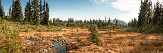
Sunday May 14th I led a group of 9 Island Mountain Ramblers and guests on a long day hike through a portion of Strathcona. We hiked from Paradise Meadows, starting at Raven Lodge through the rolling low alpine meadows, beside many ponds and lakes and lightly treed regions to Wood Mountain, frequently called the Forbidden Plateau. Paradise Meadows is by far one of the most visited places in the park. It is the launching point for many day hike and multi day adventures. Many hikers will be familiar with the Wood Mountain/Forbidden Plateau Parking Lot as it is the usual launch point for hiking Mount Becher, Boston Ridge, Mount Drabble and more.
![]() |
| GPS Route to Wood Mountain with Photographs |
Total Distance: 26 km
Total Elevation Gain: 730 m
Total Time: 8 hours
Lee Plateau
— Submitted by Ken Rodonets
Keeha Bay & Meeting my Hero
–Submitted by Matthew Lettington
![]() |
| Hemingway assisting in raising the tent at Keeha Bay |
Victoria Day, May long weekend, or May-long, no matter which you call it it’s one of the best weekends for camping! It hardly matters if it rains or shines, its a symbol of transition out of the long wet winter and spring to the long awaited summer. The past few years I have marked this transition by hitting the beaches of Vancouver Island, hiking the plethora of coastal hikes available to us.
This year, I led a a group of Island Mountain Ramblers and my family, nine people in total to the aggregate sand beach of Keeha Bay. Located in the Pacific Rim National Park. Keeha Bay is near to the northern trailhead for the West Coast Trail, close to Pacheena Bay. Unlike the West Coast Trail, the Keeha Bay Trail receives very little official maintenance, has very little elevation gain and is one of the shortest trail hikes to the gorgeous beach, which is not often visited. Sounds pretty amazing right!? Wrong! In actual fact the trail is the muddiest I’ve ever hiked and has a large number of technical challenges that make the short distance a lengthy to hike.
Maple Mountain and Samsun Narrows
![]() |
| Lunchtime |
Mt Tzouhalem — Hike & Flower Hunt
–Submitted by John Young
Another lovely jaunt up beautiful Mt. Tzouhalem. Picturesque clouds in the morning, and then cleared off, and warmed up in the afternoon. Spent a little extra time wandering around the bike trails, making it a 6 hour outing, including many breaks. Many other people up at the cross enjoying the great view. Some flowers out, and fresh growth on the Garry Oak was beautiful.
Mt Cokely to Base of Mt Arrowsmith Gully
— Submitted by Clark Gourlay,
— Author Wanda Hill
ACC combined with Island Mountain Ramblers trip Apr 25, 2015. Traverse Mt Cokely to the Base of Mt Arrowsmith Gully and hike out climbers trail to the road. Organized and let by our fearless leader Clarke. Particpants included Clarke, Roger, Peggy, Monica, Wendy, Sandra and Wanda. We arrived to find loads of fresh snow. The trip took us 8 1/2 hours using various combinations of snow shoes and crampons. Thanks to Roger for breaking trail most of the way and Clarke for the excellent route finding. This route was moderately strenuous with beautiful scenery and some short steep and airy sections.
Maude Island
— Submitted by John Young
Surviving the Wild Side Trail with 21 Month Old Hemingway
When does the summer start? For many Families living on Vancouver Island they might say, May long weekend as this is when many make their first camping trip of the year. For my family, Easter weekend holds a tradition in my family, not just a lowly ham and/or turkey but a tradition of camping.
This Easter I picked the Wild Side Trail as the destination for Hemingway’s first backpacking trip. The 11 km of walking combines easy beach walking and a small mount of forest walking, over headlands. It’s satisfactorily long, worth the effort. It features beautiful west coast rainforest and offers opportunities for wild life encounters. Further, the wilderness is old-growth forest; one of the few areas left on the west coast. The route brings hikers past dozens of forest-giants, moss so thick you’ll want to lie down and sleep forever, and at least a few Culturally Modified Trees. Adding tot he fun, I brought the Island Mountain Ramblers with us. In total 15 people hiked and camped, including three children.
![]() |
| Flores Island’s Wild Side Trail GPS route |
Total Distance: 34.6 km
Time: about 9 hours of hiking over 3 days
In Search of an Island Peak
of us will remember the story from Looney Tunes cartoons about Pepe Le’Pew and
his obsession with trying to win the affection of Penelope the cat. Nothing he
seemed to do would win her over but he never stopped trying and remained
determined. It may seem an odd
comparison but the Vancouver Island Mountains were playing hard to get and I
was determined to spend some time with them on the upcoming weekend.
earlier I had just completed a successful and exhilarating climb of a beautiful
Alberta mountain top which followed by a week on the Saskatchewan Prairies. To
say the least I was left longing for some elevation after that climb and then
transition to the flat farmland. While I was away I chatted with a few fellow
alpine enthusiasts on what plans we could formulate. The typical back and forth
texts and social media conversations took place and we finalized our plans on
three peaks in three days in Strathcona Park upon my return home. Well, so we
thought they were finalized.
been extremely mild on Vancouver Island this year and the ability to access and
climb otherwise difficult zones remained an attainable feat. That was until the
weather took a huge turn the Monday prior to the weekend we were to set out.
Strathcona Park region was forecasted to get 300 mm rain at lower elevations
and anywhere from two to four feet of snow at the summits. The drenched hikes
and avalanche risks at higher elevations immediately killed all those plans. I
think I refreshed mountain-forecast.com every 30 minutes for the next 4 days
and checking island weather systems constantly to find a window of bearable and
safe climbing conditions. I found our peak on Thursday afternoon and it would
be a Saturday adventure on Mount Arrowsmith.
is by far the most popular and tallest peak on South Vancouver Island standing
at 1817m. With easy trailhead access off highway #4 just east of Port Alberni
it boasts multiple climbing routes of all types and skill levels from scrambles
to technical climbing. I shared my choice of peak with the crew consisting of
Patrick and Pearce whom I had climbed with prior on Triple Peak and Ian whom I
had completed Mt Landale with, it would be his first time to this mountain.
They were in agreement and together we picked our route to the summit. Our plan
was to start on the Climbers Trail which gives us access to the NW side of the
Mountain and the upper cirque. Here we would climb the main snow gully to just
below the Main Summit and achieve our goal. We would descend via Judges Route
to our vehicles and conclude the day. The plan was set and then I told them we
would need to be on the road by 4 am (3 for Ian) so that we could be hiking by
6am to beat the weather system that would hit after lunch. As Patrick chuckled
in our discussion, “the things we do for fun”.
the usual laying out of all the gear, going over the checklist and making sure
all was all in place. Stuff, jam, stomp and cinch everything into my pack then
gathering everything by the door for the early morning departure. Ian arrived
at the house at 4am Saturday morning and off we went, stopping at the first
available coffee spot as every good journey starts with the goodness of
caffeine. We were on the road to rendezvous with Patrick and Pearce just before
Cathedral Grove and drive the logging roads to the trailhead together. The
drive up was positive as the skies remained clear and only a small bit of rain
was encountered keeping our hopes high. We met with the other half of our group
and arrived at the trailhead at 530am.
readied ourselves with our gear and then pulled out our headlamps for the pre
sunrise start in the dark at 6am, right on schedule. The start of the trail
descends immediately down to the creek allowing us to cross its path. After
that it is onwards and upwards through the forest with the Arrowsmith peaks to our
right and the cascading waterfalls of the creek to our left. After about 1km we
arrived at a steep rock slab that marks the entrance out of the treeline into
the lower cirque. A nice permanent hand line is left here to aid passing this
obstacle, I went first followed by Pearce and then Ian. Patrick was to come
last but unfortunately it was at this point that his knee injury from a
previous climb let him know he wasn’t ready for a summit quit yet. I feel the
most admirable quality to be had in the mountains is knowing when to proceed or
not, common sense and sound judgement as there is no room for poor decisions in
the alpine. Patrick would turn around and descend back down Climbers Trail to
the vehicles and wait for our completion of the day. I commend him for this
tough decision as I imagine he wanted the summit as badly as we did.
now threesome continued out of the trees and emerged into the first clearing
that would be the last push to the lower cirque. It was at this point we saw
our only glimmer of the sun through the clouds which last but a brief moment to
only be quickly swallowed by the low hanging clouds. That would be the onset of
the socked in cloud cover of the day and the start of the cool wind as we put
on our next layer of coats without the protection afforded to us by the
treeline below. Pearce commented on how the spot we were at should have been
completely engulfed in snow, it was barren and a sign of the changing weather
patterns of the island.
steadily gained elevation and completed the climb past the Lower Cirque and
paused at a tarn covered in broken ice. Nestled into the trees on the tarns
edge we put on another coat, had a quick snack and continued onto the Upper
Cirque which would be the start of the Main Snow Gully up to the summit. The
gully rises roughly 160m vertically at a 45 degree angle and provides a superb
winter route which is rated as a PD+ 4th Class – A1 2 climb. The
wind was really starting to gust strongly at this point, we found the shelter of
a tree where we fixed our crampons to our boots and put on our climbing
harnesses with ice axes roped securely.
led us up into the lower section of the gully kicking steps into the firm yet
manageable snow with myself and then Ian in tow. We made a bit of distance when
I offered to lead the route, mostly as I was eager with excitement to attack
the route. Our first obstacle was a rock that in other years would be buried by
the snow but with current conditions was left exposed and required a tricky
step but manageable, I made it past and then Pearce followed by Ian right
after. It was now a steady and straight shot to the top of the gully. I enjoyed
this part of the climb and am certain it will be visited many times more in the
future as well as to see what was most likely a beautiful view obscured by the
clouds and fog that had chosen to be our climbing partners for the day.
emerged at the top of the gully over a tiny cornice to a scene nearly barren of
snow just below the main summit. I had climbed the SE side of the mountain back
in January and it was blanketed in deep snow as compared to the current ice and
frost layer. Pearce and then Ian took their final steps out of the gully for
celebratory high fives on the satisfaction of a successful gully climb. We then
joined onto Judges Route which would take us the final 80 or so meters to the
main summit via easy rock with 3rd class scrambling.
we crested onto the top of the summit we were greeted with a blast of wind full
of fury which just added to the experience. I found the summit register and
broke it free from the mountains ice covered clutches with my axe and took
shelter behind one of the weather towers that sits atop the summit. Here we
wrote our piece in the register and then secured it back in its resting place.
With a socked in white blur of cloud and fog aided by gale force gusts layered
with snow and mist, enough time had been spent on the summit at this point.
climbing a mountain the view isn’t always important when the journey itself can
be as fulfilling.
path down would follow Judges Route all the way back to the logging road on the
opposite side of the summit that we had ascended. It was only about 100m off
the peak when the wind was completely gone as well as the snow and ice. We
quickly found ourselves in calm relaxing surroundings with a rapidly rising
temperature to our enjoyment spurring the removal of our winter layers and
removing our crampons, packing away our ice axes in favor of our walking poles.
Our downward trek continued for about 30 minutes when we heard a grumbling.
it wasn’t a bear or cougar, it was our stomachs. After 5 hours of steady
physical exertion it was time for a mountain side cookout. Off with the packs
and out with the stoves busy as we each prepared our favorite meals and some
tea and coffee, modern day cooking and food while in the woods has never been
easier. With our bellies full and our spirits high after reliving what only a
short time ago we just completed, it was time to pack up and carry on.
made short work of the switch backing trail that descends back to the Trailhead
for Judges Route through nice old forest typical of Vancouver Island. At the
trailhead we are greeted with a 2.5km hike back down to the logging road via a
decommissioned spur and to the mainline under a light mist of rain. We were
greeted by Patrick who successfully made his own solo return after parting ways
with him earlier in the day. He had a smile on his face and a fire started
around which we could recount the tales of the day and the summit conditions we
experienced. As we were chatting the skies opened up to a heavy rain, my
scheduling to climb within the weather window worked out perfectly. Our day saw
us achieve 5.7km total distance with 951m of ascent and 1115m of descent in a
timeframe of 6 hours 36 minutes.
you were to wait for perfect conditions I don’t think a person would find
themselves outdoors often. Embrace our wild and open places we call home here
in Canada, it truly is an amazing diverse place.
Something #BeyondTheUsual
Istace